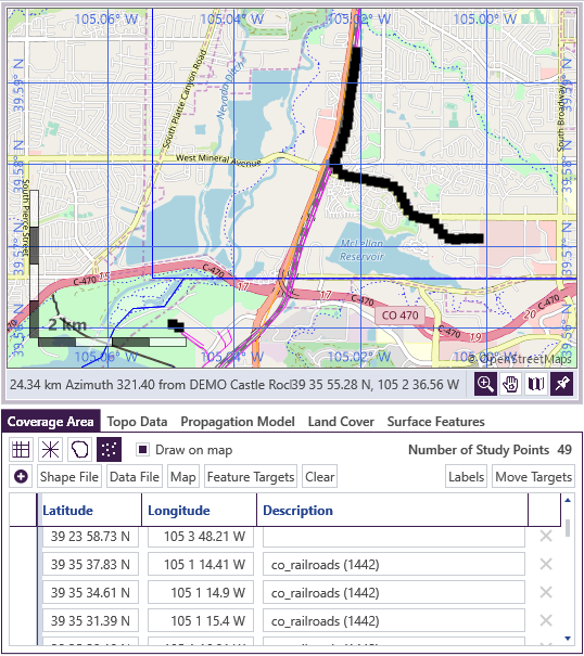
Feature Targets are a way to generate points for target studies. It allows the user to select map features (e.g., roads, railroads, pipelines, or power lines) and then generates evenly-spaced target points along that feature (or feature boundary for polygons).
See the built-in TAP software help documentation for step-by-step instructions to add shapefile data to the map and create Feature Targets along a path or boundary of interest. When finished, a Target study will be run with the auto-generated target points similar to the image shown below.
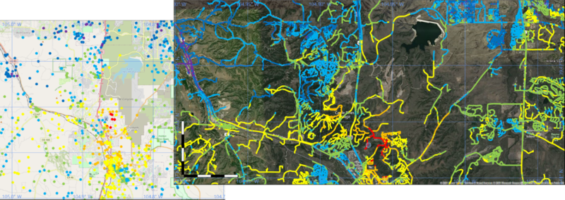
Example results are shown in the right-hand side of the image below.