FAQs

Can I view a path profile in 3D exported to Google Earth?

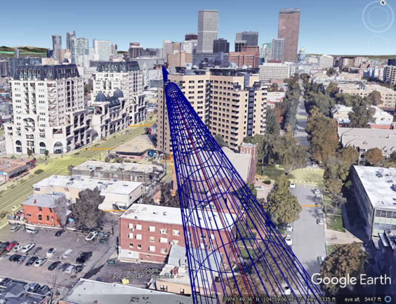
TAP™ licenses including the 3D Display Module provide the ability to create a KML file to display a path profile in 3D in Google Earth.  TAP creates a mesh to display the entire Fresnel zone region to better visualize the effect of obstructions along the path:

Microwave Path in 3D in Google Earth
Microwave Path Showing 3D Fresnel Zone


Possibly Related FAQs

Download a fully-functional demo version of our Terrain Analysis Package software.

Download