We are pleased to announce that we have recently released Terrain Analysis Package (TAP™) 7.6.6 with several exciting new features headlined by built-in support for new international land cover data and an enhanced Antenna Manager. Highlights of TAP™ 7.6.6 include:
- Support for New International Land Cover Data: We are now offering global land cover data at 10m resolution from the European Space Agency. This compares to the approximately 450m resolution MODIS land cover data that we supported previously. This new dataset is especially useful for the recent Land Cover Clutter feature that applies obstructions based on land cover category.
- Enhanced Antenna Manager: The enhanced Antenna Manager features greatly improved functionality for filtering and searching the antenna database, specifically: (1) we’ve added a character string search; (2) the filtering is now performed over all libraries; (3) the number of antenna models meeting the search criteria is shown for each library in the list; and (4) both libraries and antennas are sorted according to the filter search results.
- Kml to Shapefile Conversion: Improved kml to shapefile conversion for kml files with multiple shape types (e.g., points, lines, and polygons).
- Web Basemaps on High-Resolution Displays: Improved web basemap rendering on high resolution (e.g., 4k) displays.
NEW INTERNATIONAL LAND COVER DATA
In the series of new features to make TAP™ RF analyses even more detailed, we recently added the capability to raise terrain height (i.e., automate creation of surface features) based on land cover category. Click here for more details. This feature has been highly useful in the United States due to the availability of NLCD land cover data with approximately 30m resolution. However, it is less valuable outside of the U.S. due to the low resolution (approx. 450m) of our best available MODIS international land cover data.
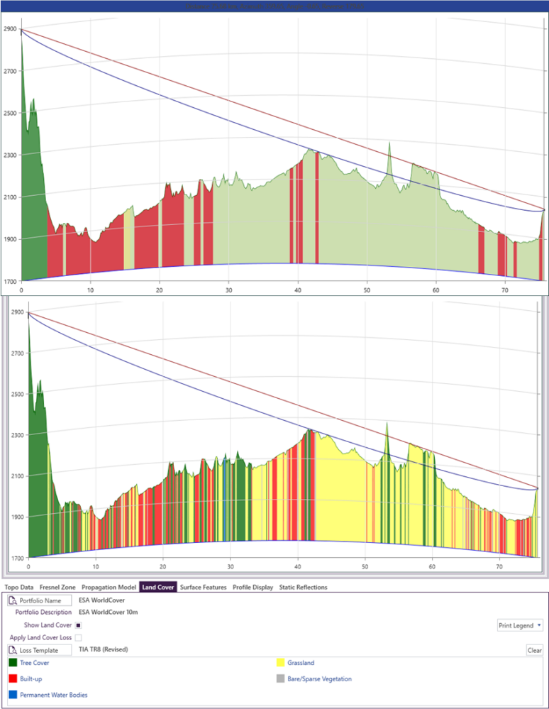
With the release of TAP™ 7.6.6, we now feature built-in support for the European Space Agency’s ESA WorldCover 2020 dataset. Although there are only 11 land cover categories (as compared to 36 for NLCD), the 10m resolution data makes it an excellent choice for global Land Cover Clutter. Contact sales@softwright.com to inquire about upgrading to the new WorldCover 2020 data set. Note the comparison below between the older MODIS data and higher-resolution WorldCover 2020 data along a path in Denver, CO, USA.