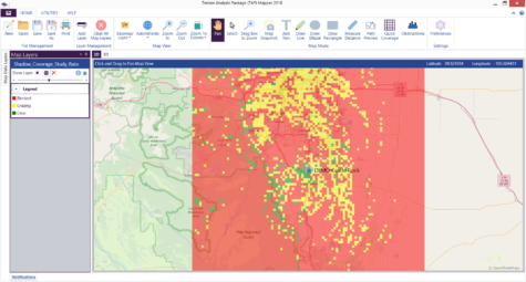
The Shadow Map Module identifies locations that: 1) are shadowed (obscured) by terrain or obstructions; 2) have line of sight, but obstructions within the specified (e.g., 0.5 first) Fresnel zone for a specific frequency, and 3) have clear line of sight with no obstructions within the specified Fresnel zone. For specified transmit and receive antenna heights, the shadowed areas around a site are clearly identified.
Using this tool will greatly ease the location of unobstructed paths for distant receivers from a particular site for applications such as microwave and SCADA. Results are dependent upon antenna heights, frequency, terrain, obstructions and path geometry. However, the Shadow Mapping module is not a propagation model and received field strength is not calculated.