The National Weather Service in Louisville, KY operates a weather radar at Fort Knox. It does sweeps at elevation angles of 0.5º, 1.0º, 1.5º, etc. at a frequency of 2.895 GHz. When initially installed nearly 20 years ago, there were no issues with blockages due to terrain or vegetation. Recently, seasonal blockages have emerged in the northwest, northeast, and southeast quadrants for the 0.5º angle sweep due to increases in the maximum tree heights on the surrounding hills. These are overcome with filtering techniques.
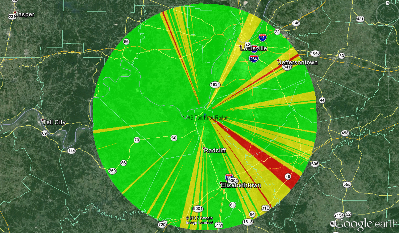
As a case study, TAP was used to assess the effect of vegetation in the vicinity of the radar site. The fixed facility was placed at the radar site. A surface feature file was generated with vegetation covering the hills near the site. Tree heights were 80 feet. Radial studies were set up with and without surface features included. For the propagation model, Shadow Fixed Angle was selected, which assesses line-of-sight at a fixed elevation angle. Since the sweeps are spaced at 0.5º, and the lowest sweep is at 0.5º, the fixed angle was set as 0.25º. This allows the study to capture features that impinge on the lowest edge of the beam and could cause false returns. The radial studies were run out to 50km. Since TAP release 2532 includes the ability to run accelerated studies including surface features, the new capability was used to run this study.
When no surface features were included, no blockages were seen. When run with the surface features included, blockages were seen in the northwest, northeast, and southeast quadrants, as seen in practice. Line-of-sight blockages are shown in red in the below figure. The areas in yellow have partial blockage of the Fresnel zone, but clear line-of-sight. These areas may be affected by future tree growth.