Q: When I plot a coverage, TAP plots the boundary file for the entire state. How can I limit the plot to just the counties affected by my coverage?
A: You can create new boundary file(s) with just the area you want included using the Boundary File Filter functions, or using the Boundary File Trim function:
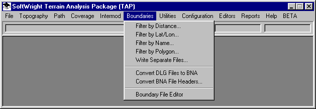
Boundary Filters
You can create new boundary files using the filter functions. These functions area available from the Boundaries menu:
In each filter, you specify the .BNA boundary file(s) to use as an input. A new file is created based on the filter you select:
Filter by Distance allows you to enter the coordinates of a location and a distance. All objects in the input file within the specified distance are written to the output file.
Filter by Lat/Lon allows you to enter the north, south, east, and west coordinate limits. All objects in the input file within the specified limits are written to the output file.
Filter by Name allows you to scroll through the input file and select the individual objects (based on the object names in the BNA file) to write to the output file.
Filter by Polygon allows you to select a polygon from a map (such as county, a coverage contour, or a polygon you have drawn). The BNA input objects in this polygon are written to the output file.
Write Separate Files allows you to write each object (such as counties) in the input file to a separate BNA file.
After you have created the new BNA boundary file from the filter functions, you can use the file in maps you create with TAP or other programs that use the .BNA format.
Boundary File Trim
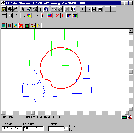
In TAP 4.4 and later, the boundary file(s) you specify on a plot can be "trimmed" at the time you draw the coverage map. The BNA files are not actually modified, but the program draws only those objects in each file that are within a rectangle bounding the coverage(s) being plotted. When the plot process starts, the program reads each of the coverages to determine the minimum and maximum extents of the coverage. These minimum and maximum values define a rectangle used to filter the boundary files.
For example, consider a contour selected, along with two boundary files as shown:
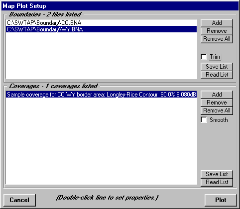
You can double-click each of the boundary files lines and the contour line to set the color for each item in the lists.
With the "Trim" box unchecked, the map is plotted with the all of the objects from all the BNA files:
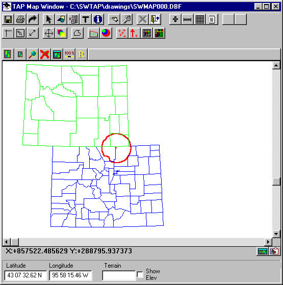
You can plot the same map but mark the Trim box:
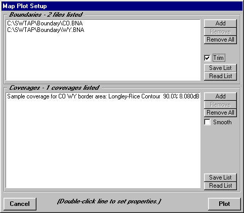
Now the map will be plotted with only the objects in the proximity of the coverage:
Copyright 2001 by SoftWright LLC