Boundary File Filters - Distance

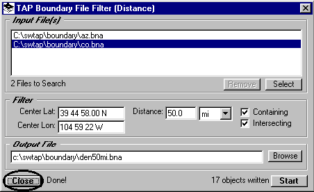
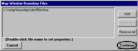
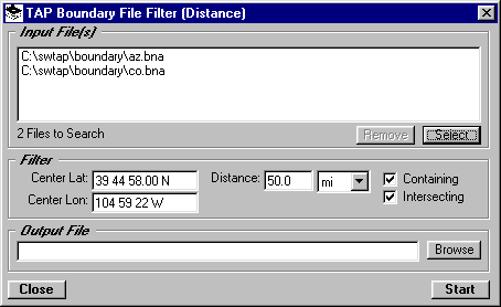
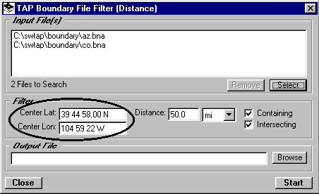
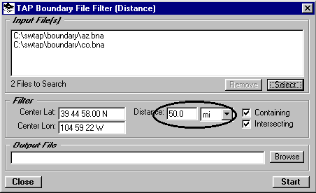
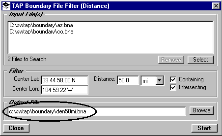
Q: I don’t want to plot the entire state boundary file with my relatively small coverage area. How can I plot just a part of the file within 50 miles of my transmitter site?

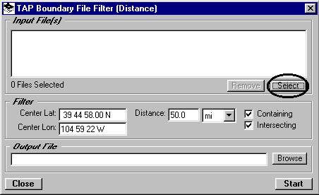
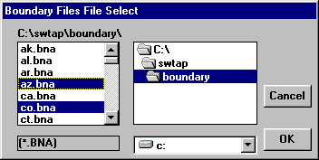
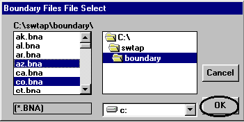
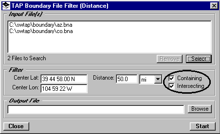
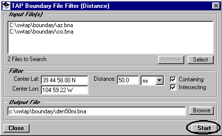
A: The TAP Map Window plotting allows you to plot boundary files you select. If you want to plot only part of a file, you can use one of the boundary filter programs to create a new file containing only the objects you want to plot. (With the Map Window, you could plot the entire file, then use the zoom features to show and print only the area of interest. However, using the boundary filter programs will allow you to save time and disk space for the drawing file.)

Several filter options are available, depending on what you are trying to do. You can filter by:

This document describes using the filter by distance program.
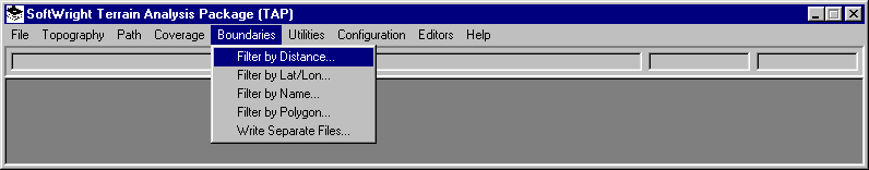
Filter by Distance

  1. Suppose you want all of the county boundaries within 50 miles of a particular location (such as your transmitter site). From the TAP Boundary menu, select "Filter by Distance".

  2. This will display the Distance Filter form. Click the "Select" button to choose the input files you want to read and filter:

  3. You can select the boundary file(s) to use. To select multiple files, hold down the Ctrl key and click on each file you want. (In this example, the Arizona file is selected to illustrate the multi-select option.)

  4. Click "OK" to use the files you have selected.

  5. The selected files will be displayed in the "Input Files" list:

  6. For the distance filter, we need a reference point and a distance. Enter the coordinates of the reference point, such as a transmitter site, the center of a target coverage area, etc.:

  7. Enter the desired distance and units:

  8. The check boxes marked "Containing" and "Intersecting" allow you additional control over the results of the program that are written to the output file.
  9. If you want objects (county lines, roads, etc.) in the input boundary files that are completely (i.e., all points) inside the specified distance, check the "Containing" box. If you want to include objects that are partly within the distance (i.e., some points are within the distance, and some points are beyond the distance), check the "Intersecting" box.

  10. For example, if you want only those counties that are completely within 50 miles, you could check the "Containing" box and uncheck the "Intersecting" box.
  11. Enter the name of an output .BNA file where you want to write the results. (You can also use the "Browse" button to find an existing path and/or file.)

  12. Click the "Start" button to begin the filter process:

  13. If the path you entered does not exist you will be prompted with a question about creating the path:

  14. If the file already exists, you have the option of overwriting the file or appending to the existing file:

    \
  15. When the filter process is completed the number of objects written to the new file will be displayed near the "Start" button. Click the "Close" button to continue.

  16. To view the file you just created, select "New Map" from the TAP File menu:

  17. On the Coverage Plot form, click the "Boundaries" button:

  18. Find the path and file you just created, then click the "OK" button:

  19. The file will be displayed in the boundary file list. Click the "Continue" button:

  20. On the Coverage Plot form click the "Plot" button:

  21. The filtered boundary file will be displayed, showing only those counties within 50 miles of the specified site.


Copyright 1999 by SoftWright LLC