Boundary File Filters - Separate Files

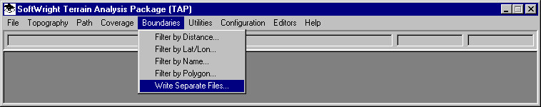
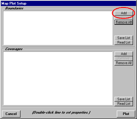
Q: I don’t want to plot the entire state boundary file with my relatively small coverage area. In addition, I want to plot certain counties as a different color. How can I plot just a part of the file I want in the colors I want?

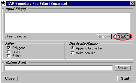
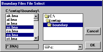
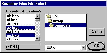
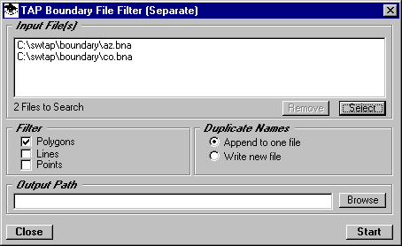
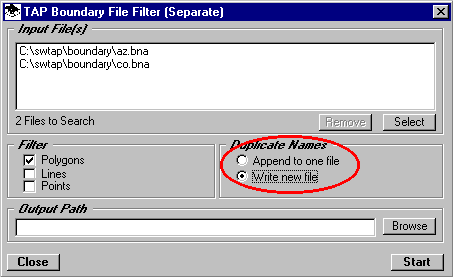
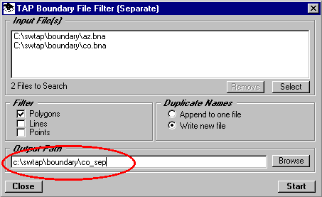
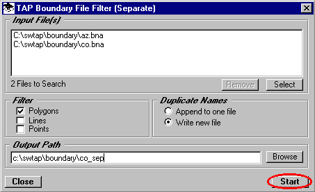
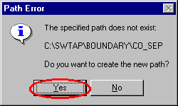
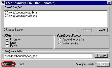
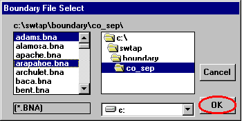
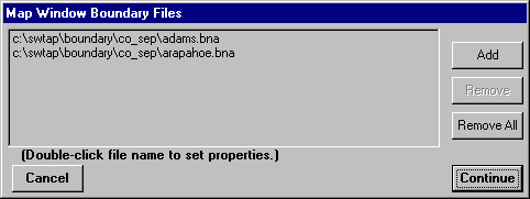
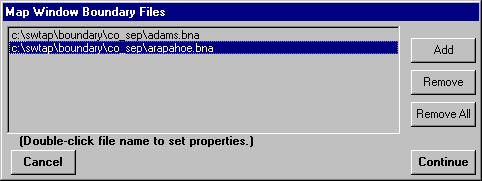
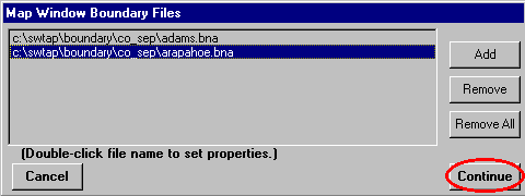
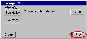
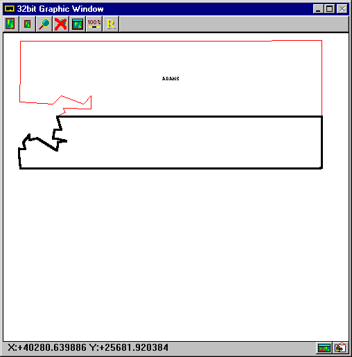
A: The TAP Map Window plotting allows you to plot boundary files you select. If you want to plot only part of a file, you can use one of the boundary filter programs to create a new file containing only the objects you want to plot. (With the Map Window, you could plot the entire file, then use the zoom features to show and print only the area of interest. However, using the boundary filter programs will allow you to save time and disk space for the drawing file.)

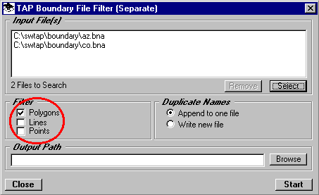
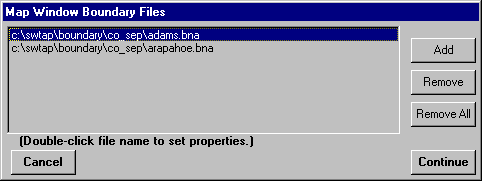
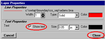
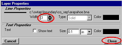
In addition, TAP plots all objects in the boundary file in a specified color. By writing the objects (such as county lines or ZIP codes) to different files, the colors for the different files can be customized. (With the Map Window, you could also plot the single file with all the object, then select desired objects to change the color.)

Filter by Distance

  1. Suppose you want to write all of the county boundaries as separate files so you can select the counties you want to use. From the TAP Boundary menu, select "Write Separate Files".

  2. This will display the Separate File Filter form. Click the "Select" button to choose the input files you want to read and filter:

  3. You can select the boundary file(s) to use. To select multiple files, hold down the Ctrl key and click on each file you want. (In this example, the Arizona file is selected to illustrate the multi-select option.)

  4. Click "OK" to use the files you have selected.

  5. The selected files will be displayed in the "Input Files" list:

  6. For the filter, we need a specify the type of object(s) to write. For example, if a file contains polygons (such as county lines, ZIP codes, etc.), lines (roads, rivers, railroads), and points (reference points, city locations), you may only want to write separate files for some of the types. You may want to write the polygons but not lines and single point objects. Use the Filter check boxes to specify the type of objects you want to write to separate files.

  7. The names of the files to be written are based on the Secondary ID of each object. In the event that duplicate file names are generated, you can either append all the objects into a single file, or to create separate files. For example, counties named "Saint Louis" and "Saint Louisville" could either be written with both objects in a single file named SAINT_LO.BNA, or to two files, the first named SAINT_LO.BNA, and a second file named SAINT_01.BNA. For this tutorial, use the Duplicate Name option buttons to select the option to write separate files:

  8. Enter the name of an output .BNA file where you want to write the results. (You can also use the "Browse" button to find an existing path and/or file.)

  9. Click the "Start" button to begin the filter process:

  10. If the path you entered does not exist you will be prompted with a question about creating the path:

  11. When the filter process is completed the number of objects written to the new files will be displayed near the "Start" button. Click the "Close" button to continue.

  12. To view the file you just created, select "New Map" from the TAP File menu:

  13. On the Coverage Plot form, click the "Add" button in the Boundaries section:

  14. Find the path and files you just created, then click the "OK" button:

  15. The file will be displayed in the boundary file list. Click the "Continue" button:

  16. Double click on the first file:

  17. On the Layer Properties form, be sure the Show Text box is checked. You can also double click the color box to change the color for this file. Click the "Close" button:

  18. When the Map Window Boundary File form is displayed again, double click on the second file:

  19. For this file, be sure the "Show Text" box is unchecked, and set the "Line Width" to 3. Click the "OK" button.

  20. On the Map Window Boundary Files form click the "Continue" button:

  21. On the Coverage Plot form click the "Plot" button:

  22. The filtered boundary file will be displayed, showing the counties selected as separate files with the individual properties of line width, text, etc.


Copyright 1999 by SoftWright LLC