Microwave Communication Systems
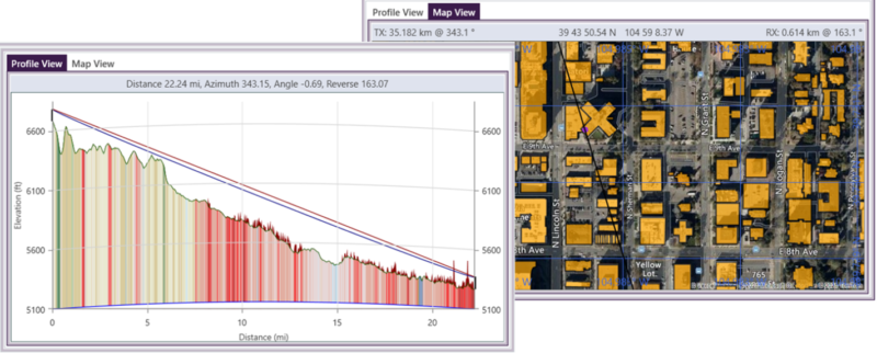
TAP7 includes numerous tools that can be used for the design and analysis of microwave systems. A path study enables detailed assessment of the path profile over terrain. Line-of-sight clearance can be evaluated using high-resolution topographic data and surface features – to incorporate path obstruction from buildings and foliage. The user may define and adjust the Earth curvature and Fresnel parameters used for the profile. The assessment may also benefit from the inclusion of land cover data via the Land Cover module. TAP7 supports seamless switching between profile and map views to improve the user’s spatial orientation.
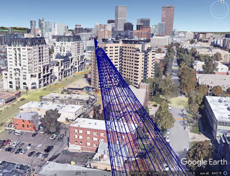
The 3D Display module allows a TAP7 user to export a 3D Fresnel mesh to a KML file, which then opens automatically in the platform’s KML-associated application (often Google Earth). The user can move along the path to further assess for current or future path obstructions.
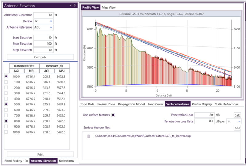
The Antenna Elevation module may be used to determine what receive antenna height is required to provide path clearance for a given transmit antenna height, or vice versa.
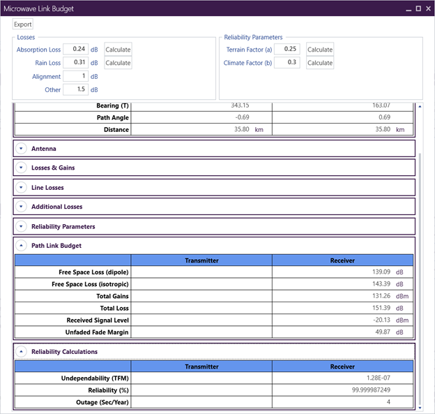
With line-of-sight clearance assured, the Microwave Reliability module provides a prediction of the link reliability percentage and outage (in seconds per year), based on the Lenkurt / Vigants-Barnett reliability calculations. The user has the option to include frequency diversity and/or receiver spatial diversity to improve reliability performance. Digital receiver specifications may also be included for a composite reliability assessment.
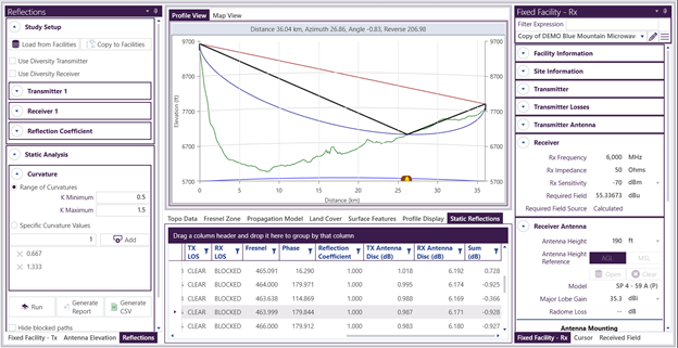
The Microwave Reflections module assesses the path profile for potential destructive interference from ground reflections. TAP7 can search for null points (associated with even Fresnel zones impacting the ground) while assessing whether the reflected path is obstructed and accounting for transmitter and receiver antenna discrimination.
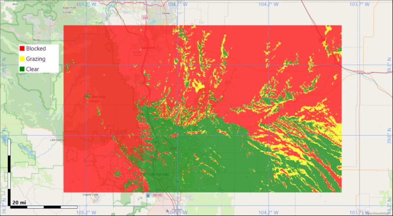
If the user wants to determine which points in an area have clear line-of-sight from a particular site location, a coverage study may be run using the Shadow Mapping module.