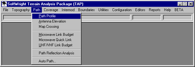
Q: How can I use TAP for a study involving a fixed angle from the antenna?
A: In TAP 4.4 and later, the Path Profile and the Shadow Map functions include the ability to fix the line of sight (LOS) angle to a user-specified value.
For most path profiles and shadowing studies for land mobile applications, the angle from the fixed antenna to the mobile unit locations varies continuously as determined by the geometry of the two antenna heights, the topography, and the distance between the antennas. For fixed-link paths (such as microwave links), the a single unique angle value is fixed, again by the geometry of the path.
In some instances, such as determining a radar horizon for a specific antenna angle, the ability to specify and fix the angle independent of the mobile antenna geometry may be useful.
Path Profiles
To draw a path profile with a fixed "look angle" or "take-off angle", execute the Path Profile program from the TAP menu:
On the TAP Path Setup form, enter the site information as usual for drawing a path profile:
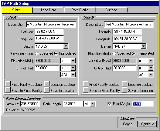
Note that when using the Fixed Angle option, the Site B Antenna Center of Radiation is ignored.
To use the Fixed Angle option, check the box in the lower right area of the form as shown, and enter the desired angle. (Positive angles are tilted above the horizon, negative values are tilted down below the horizon.)
Click the Continue button to draw the profile:
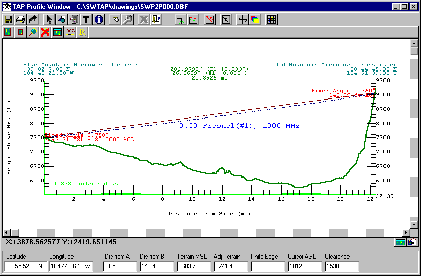
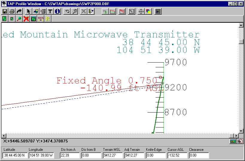
In this example, you can zoom in on the end-point site and see that the label displays the computed elevation of the line of sight at the specified location (in this case, below ground level, indicating a blocked path on this fixed angle).
Shadowing Studies
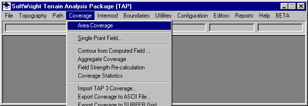
To compute an shadowing study using a fixed angle, execute the Area Coverage program from the TAP menu:
When the Area Coverage Setup form is displayed, create a new task for the fixed angle study. The study can use the Radial, Contour, or Tile selections for the type of Coverage Area:
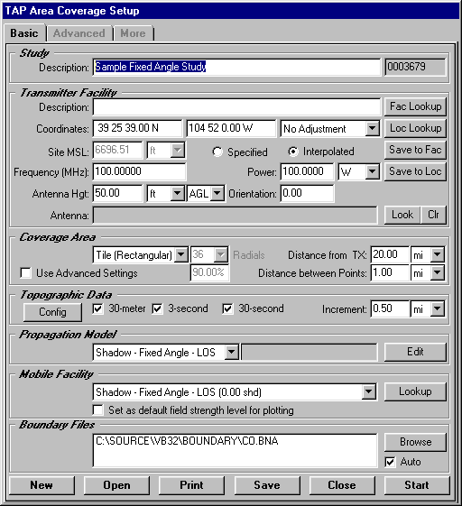
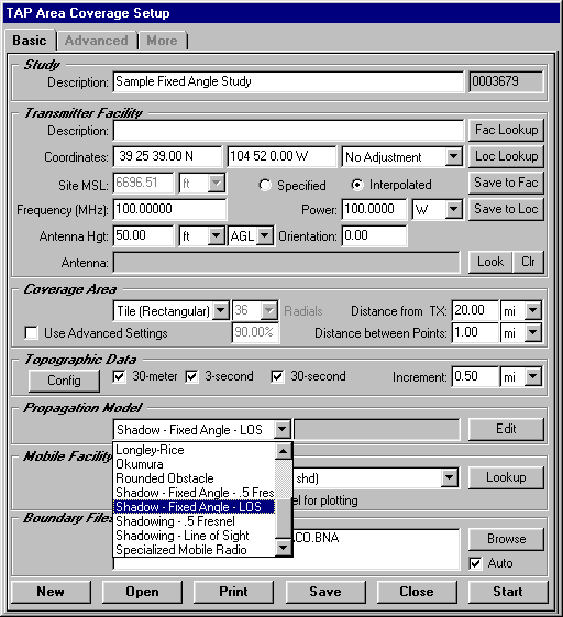
To specify a shadow study with the fixed angle option, select the "Shadow - Fixed Angle" option from the list of available Propagation Models:
To specify the angle value, you must use the Fixed Facility database. Click the Fac Lookup button to open the database.
In the database, use the Find or New buttons to locate or create a facility with the coordinates and other information for your site.
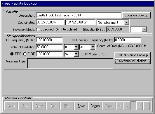
Click the Antenna Installation button to open the Antenna Installation Specs Lookup form:
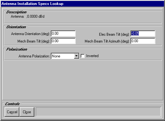
Enter the desired angle as the Electrical Beam Tilt value. (Only the electrical beam tilt value is used, the mechanical beam tilt value is ignored in Fixed Angle studies.)
Click the Close button to close the Antenna Installation Specs form and Save and Close the Fixed Facility Lookup form. The site facility information is returned to the Area Coverage Setup form:
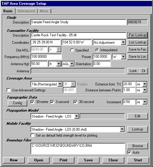
Click the Start button to begin the study, or the Save button to save the study for later execution from the File|Tasks menu.
When the study has been completed, the Map Plot Setup form is displayed:
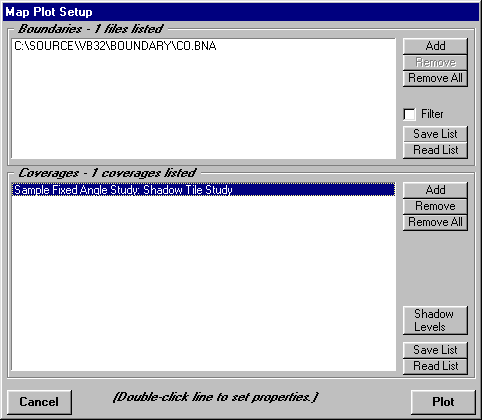
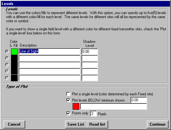
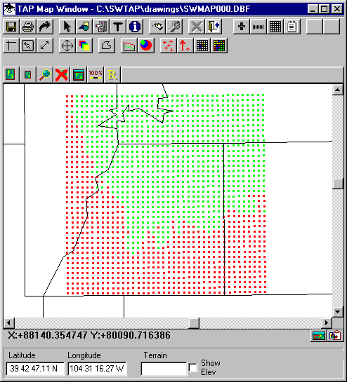
The Shadow Levels button can be used to set the colors for the levels to plot, such as green for areas with line of sight and red for areas that are blocked (based on the shadow ratio level):
When the map is plotted, the areas of line of sight are shown:
As an illustration of the effect of the Fixed Angle shadow study, you can run another study with the same parameters, except setting the Fixed Facility database Electrical Beam Tilt angle t0 +1.00 (instead of -0.05 as in the previous study).
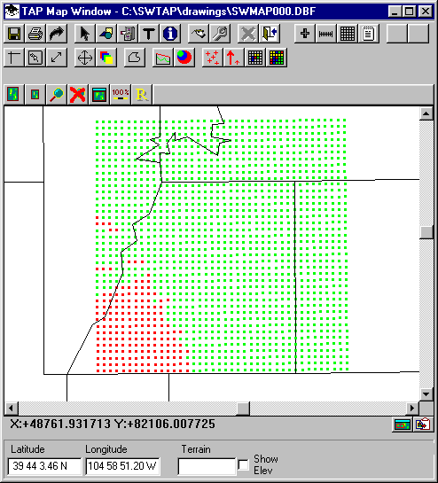
As would be expected, tilting the angle up higher clears many of the terrain obstructions in the area, producing a wider area for line of sight.
Copyright 2001 by SoftWright LLC