Exporting TAPÔ Coverage Calculations to ShapeFiles
Q: How can I use my coverage computed in TAP in a program that uses ShapeFile format?
A: TAP systems on Maintenance Subscriptions in effect on or after June 15, 2003, and updated to Build 908 or later, can export Tile, Radial, or Contour coverage calculations from TAP to ShapeFiles.
ShapeFiles can be used with several other software packages. A free ShapeFile viewer is available from ESRI. ShapeFiles from TAP can be combined with other ShapeFiles (roads, building locations, etc.) available from numerous sources on the internet.
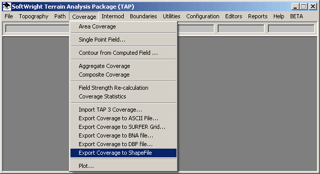
The new version of TAP has an "Export to ShapeFile" entry under the Coverage menu:
When this item is selected, the program will display a list of completed coverage study Tasks:
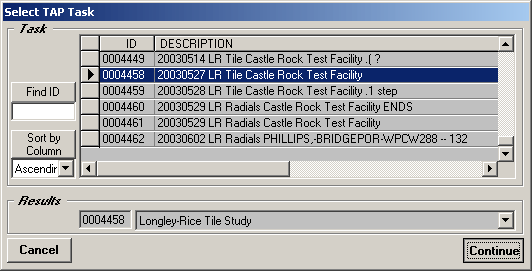
Select the coverage study you want to export to a shape file and click the Continue button.
You will be prompted for the folder and file name to write:
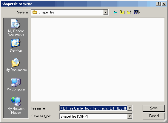
Note that the default file name is the Task description, with the type of study (in this case, "LR TIL"). When you have the folder and file name you want to use, click the Save button.
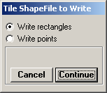
For Tile studies only, you will be prompted for the type of ShapeFile to write:
TAP Coverage Studies (Radial, Contour, or Tile) are written to ShapeFiles as shown below:
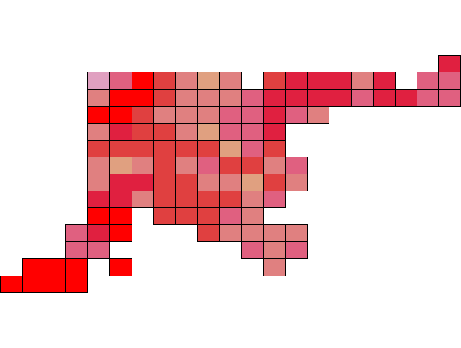
For example, a simple study of Tile points in the Denver area can be drawn as rectangles:
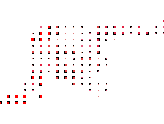
The same study can be drawn as points, with the point size as well as color indicating the value at each location:
(Many other options are available for displaying ShapeFiles in most ShapeFile-compatible software.)
Select the type of ShapeFile you want to write for the Tile study and click the Continue button.
The ShapeFile will be written to the folder and file name you selected.
Copyright 2003 by SoftWright LLC