Q: How can I compute field strength at point locations for a number of locations, such as SCADA sites?
A: You can compute field values at specific point locations using the TAP Area Coverage function.
TAP also includes an optional AutoPath module that enables you to draw profiles and compute field strength to locations. AutoPath calculations are set up by manually entering the point coordinates and other information, or by importing that information from other sources, such as an Excel spreadsheet.
This article describes the use of the Area Coverage function. You can enter the point locations manually, or import from points in a .BNA boundary file. You can create or edit BNA files with the TAP Boundary File Editor, or you can create BNA files from other software using the standard BNA format.
For example, suppose you have created a boundary file for all Colorado towns (in the CO_CITY.BNA file) within 20 miles of a transmitter site using the Boundary Filter by Distance program.
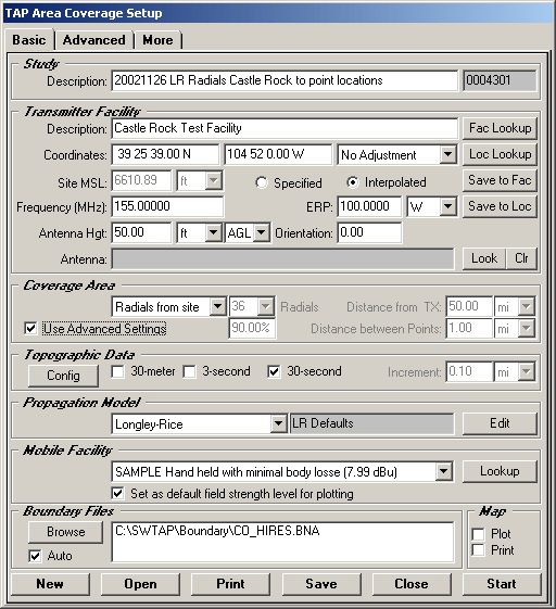
Use the Coverage menu and select Area Coverage to set up a new area coverage study:
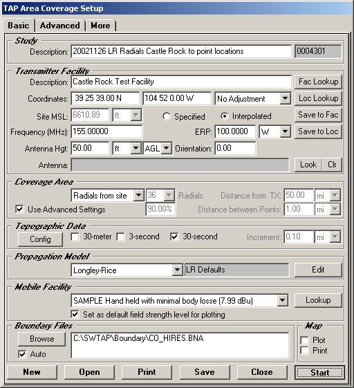
In the Coverage Area section of the form, select Radials from site as the type of study, and mark the Use Advanced Settings checkbox.
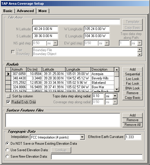
Click the Advanced tab:
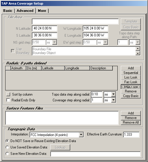
In the Radials section of the Advanced tab, you can use the Add button to enter the latitude and longitude of the target points manually, or you can use the BNA Look button to select a BNA file that contains the points you want to use.
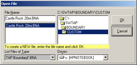
When you click the BNA Look button, you can select the file you want (for example, one you have created as described above):
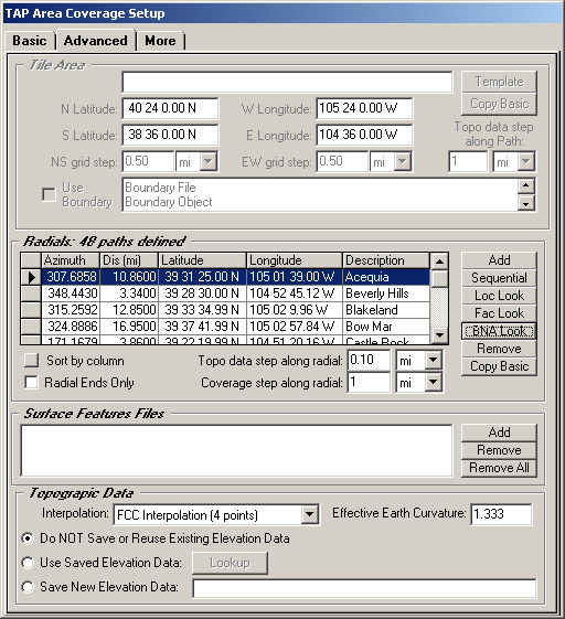
When you close the form, the BNA file is opened and the coordinates of each point are used to define new radials for the study:
If you only want the field strength at the point locations, click the Radial Ends Only box. If this box is not checked, the points will be computed along the radials out to each end point. If you are only interested in the field strength at the end points, use the Radial Ends Only box to limit the calculations:
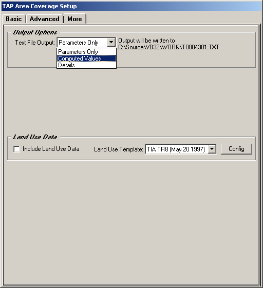
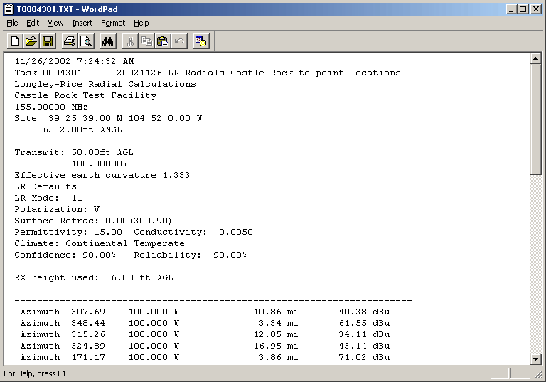
If you want a text file with the computed values, go to the More tab and select Computed Values. (The Details option will write the computed value plus details of the calculation for each point.) Note the name of the file to be created (based on the Task ID) so you can open it later.
Return to the Basic tab and click Start to begin the study:
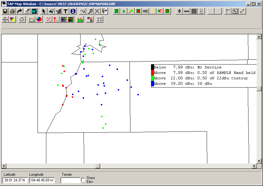
When the study is completed, you can plot it as any other area coverage study, setting different field strength levels, adding boundary files, etc.
The text file will be in the Work folder:
Copyright 2002 by SoftWright LLC