TAP6 Surface Feature Files
Q: How do I include obstructions (such as buildings or vegetation) on a profile or in a coverage study?
A: Obstruction information is saved in Surface Feature files. These are data base files that can be named and organized in whatever way is most useful for you. Typically the files are located in a directory named SURFACE below your TAP directory, such as C:\SWTAP\SURFACE.
The terrain elevation data contains topographic elevation values that can be used to compute radio propagation, including attenuation due to terrain shielding. The surface feature data base files supplement the topographic data with elevation information for manmade obstructions, vegetation, etc.
File Organization
While it is possible to enter information about all obstructions in a single data base file, this approach is not recommended. While every effort has been made to minimize increased execution time resulting from obstruction checking, careful organization of surface feature files is critical.
The more obstructions there are in a file, the greater the impact on TAP's performance, especially with the coverage studies. The recommended approach is to organize the files by geographic areas. For example, if you use TAP for studies of topography or propagation in the Denver area and in the Dallas area, separate files (e.g., SURFACE\DENVER.DBF and SURFACE\DALLAS.DBF could be used. Putting all obstructions for the two areas in a single file would unnecessarily degrade program performance when checking obstructions, since buildings in Dallas rarely affect paths in Denver. If all of your uses of TAP are in a single geographical region (such as a metropolitan area) a single surface feature file usually is acceptable.
Surface Features in TAP
All obstructions are treated as cylinders (with the given radius and height) for the purpose of defining the area affected by the obstruction. You can approximate more complex shapes by multiple vertical cylinders. (The use of cylindrical objects results in much faster operation than using arbitrarily shaped polygons, such as forests or housing areas.)
Three types of obstructions are currently supported:
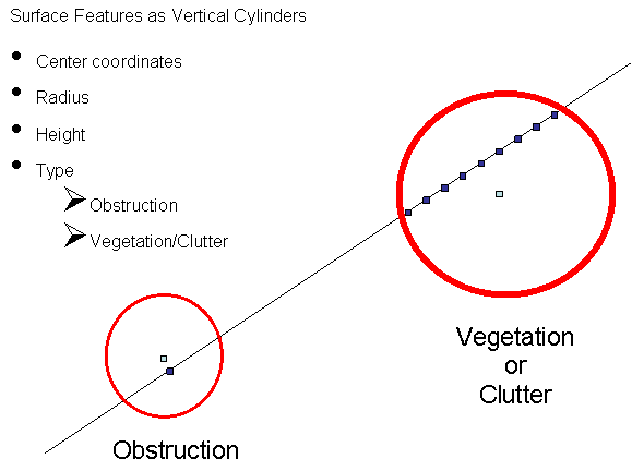
- Obstructions (buildings, water towers, etc.) are treated as knife-edge obstructions. If the cylinder centered on the obstruction coordinates with the given radius overlaps a path, the obstruction elevation is added to the closest point on the path within the radius. Only one point of the path is affected by this type of surface feature.
- Vegetation and Clutter are "blanket" features. If the cylinder centered on the obstruction coordinates with the given radius overlaps a path, the obstruction elevation is added to every point on the path within the radius. (Receiver location elevations are not affected by obstructions. The receiver is assumed to be based on the elevation of the terrain, plus the receiver antenna height, and not at the elevation of any surface feature.) In the current version of TAP, Vegetation and Clutter are treated the same. Vegetation represents features such as foliage, forests, etc. Clutter represents buildings, etc.
The difference between the knife-edge and blanket type objects is shown below:
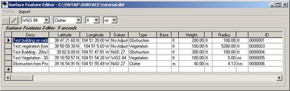
The Surface Features data bases include several items for each record.
- Description is an identifier of what the obstruction is. You can enter a description of up to 40 characters.
- Lat/Lon/Datum specify the center of the obstruction.
- Type identifies how the obstruction is handled by TAP. The type is selected with a pull-down list:
- Height is the height of the top of the obstruction above ground level (AGL).
- Radius is the radius from the center coordinates of the obstruction. All obstructions are treated as cylinders (with the given radius and height) for the purpose of defining the area affected by the obstruction.
- Base Elevation is the elevation above mean sea level (AMSL) of the base of the obstruction, such as a building. If a value is entered, the height of the obstruction will be added to that base elevation during profile plotting, coverage studies, etc. If the value is left blank, the base of the elevation will be interpolated from the terrain data when needed, and the height of the obstruction will be added to that value. The Base Elevation is typically left blank, to enable the program to find the elevation from the topographic databases.
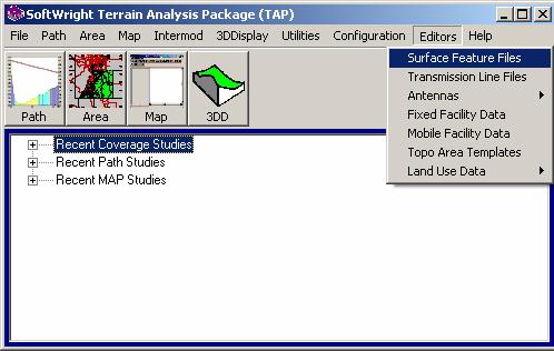
To edit or create a surface feature file with obstructions, click on the TAP Editors menu and select Surface Features:
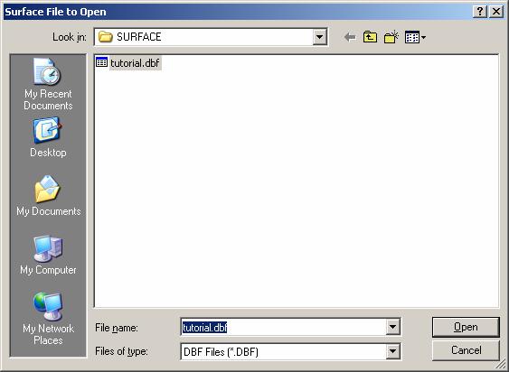
You will be prompted for a file to open. For example, you can select the Tutorial file:
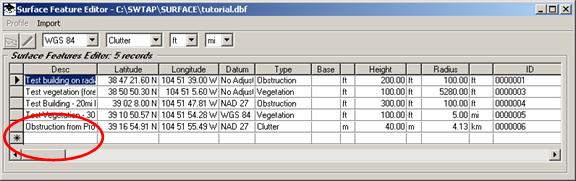
The file will be opened and the current Surface Feature records displayed:
You can add new records manually by placing the mouse cursor on the blank line at the bottom of the list (with the asterisk “*” at the left end).
When you start typing on that row, a new record is created:
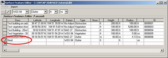
You can continue to enter values on the new row (coordinates, height, and radius).
Note that the pencil icon to the left of the row indicates the row is being edited.
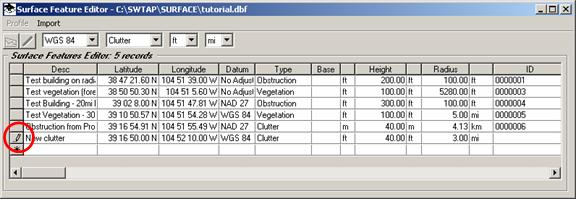
When you are finished editing the record, move the cursor up or down to another row. Moving off of the row indicates that you are finished editing, the program accepts the data, and the pencil icon is cleared.
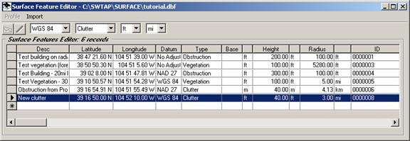
If you want to delete a record you can click the selection button to the left of the record with the mouse cursor to select the record. Then press the delete key on the keyboard to delete the record.
You can also add Surface Feature objects graphically in HDPath, and you can import dBase or Excel files to add Surface Features to use with TAP.
|
|
Copyright 2007 by SoftWright LLC