“Mouse Location” Window in HDPath™
Q: What is the information that is displayed in the “Mouse Location on Path” window when I move the mouse over a profile in HDPath?
A: The “Mouse Location on Path” Window enables you to obtain numerous pieces of information about the path as you move the mouse cursor over portions of the path that are of interest to you.
Note that all values in this example are for demonstration purposes only. You should determine appropriate settings for your application.
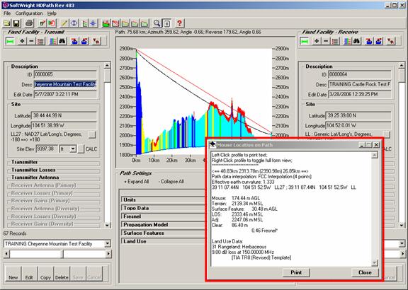
For example, suppose you have a path profile displayed and you move the mouse cursor over the profile graphic. The Mouse Location on Path window is displayed, and the contents are updated as you move the mouse to different locations on the path:
If you do not want the Mouse Location on Path window to be displayed, you can use the “minimize” button (“__”) near the upper right corner to minimize the form.
You can also use the “Close” button (“X”) but the form will be re-displayed each time you redraw the path. The minimize button will keep the form minimized even when the path is redrawn.
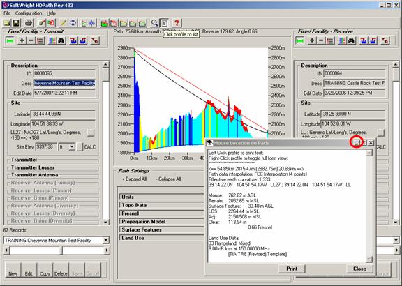
Since the information changes as you move the mouse, you may want to take a “snapshot” of the information at a particular location. To do this, be sure the “List” button is depressed on the toolbar near the top of the form.

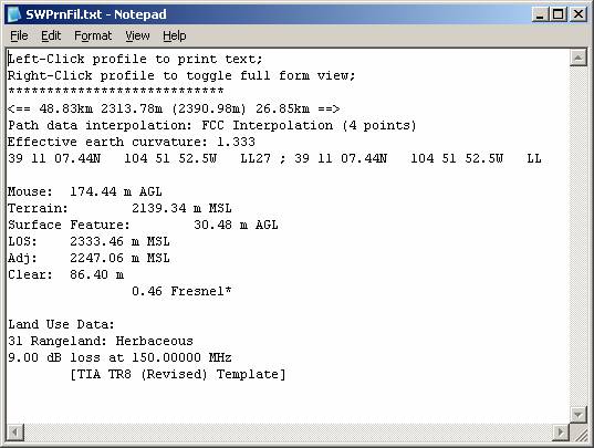
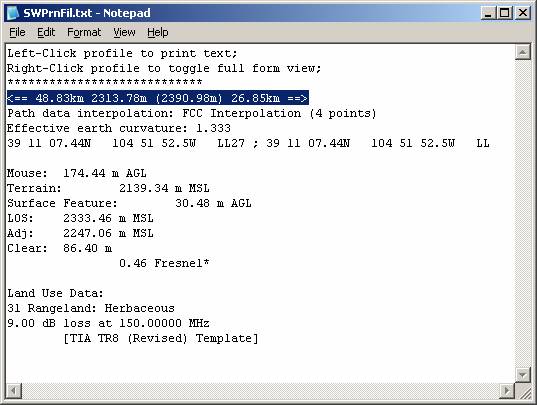
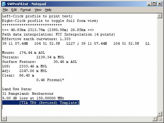
When the List button is depressed, you can move the mouse to the desired location on the path graphic. When you click the left mouse button, the contents of the Mouse Location window are displayed in a Notepad file:
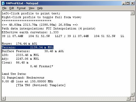
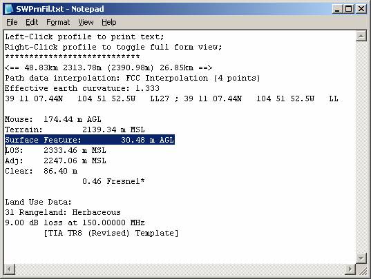
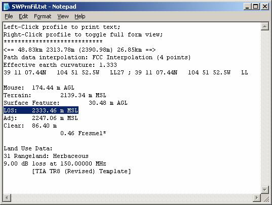
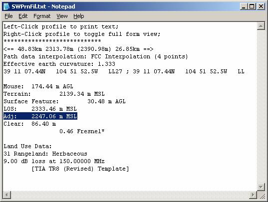
The Mouse Location information includes several useful items:
The distance from each end of the path:
The topo elevation data interpolation method used for the path
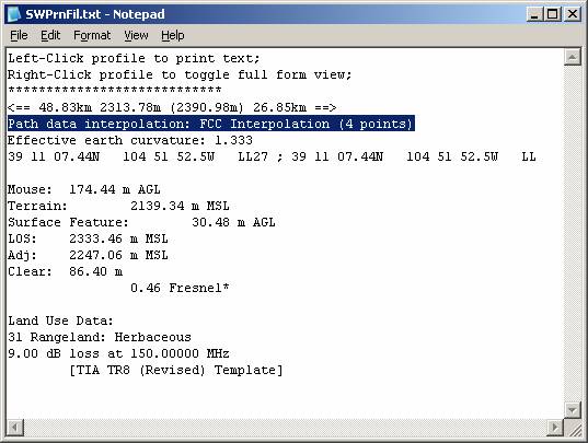
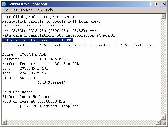
The effective earth curvature used for the path:
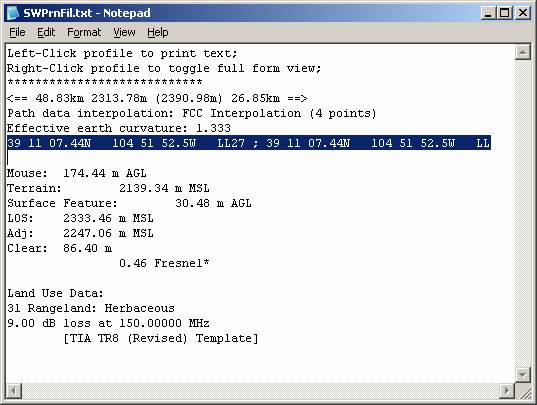
The coordinates of the mouse location (the coordinates are displayed twice, once using the datum for each of the end points):
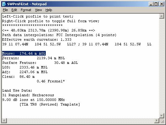
The elevation above ground level (AGL) of the mouse cursor:
The terrain elevation at the path location under the mouse cursor:
If Surface Features are included on the profile, the height of the highest surface feature object at that location:
The elevation above mean sea level (MSL) at that location of the line of sight between the antennas at the two end points.
The terrain elevation at the location, adjusted for the effective earth curvature:
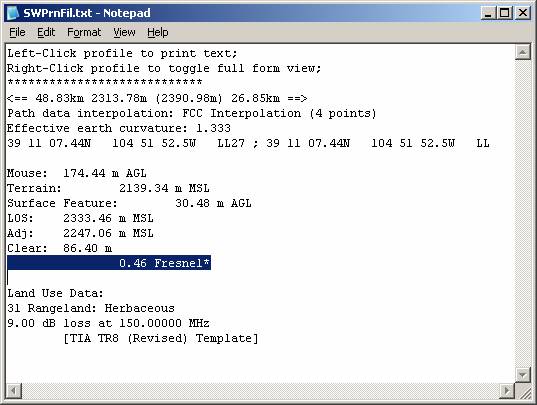
The path clearance (in feet or meters) between the terrain and surface feature elevation and the path line of sight at the location:
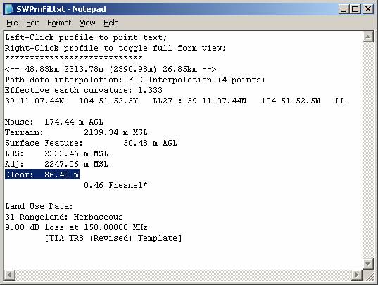
The path clearance expressed as a ratio of the first Fresnel zone for the transmitter frequency. If the Fresnel zone clearance is less than 0.5 (half the first Fresnel zone), the line is marked with an asterisk (“*”) indicating that some obstruction loss is expected because of the lack of Fresnel clearance.
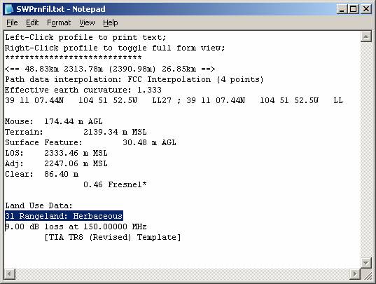
If Land Use data is included on the profile, the USGS Land Use Classification at the location:
If a Land Use Loss record is defined for that land use type, and that frequency in the selected Land Use Loss Template, the loss value assigned for a mobile receiver located at that location.
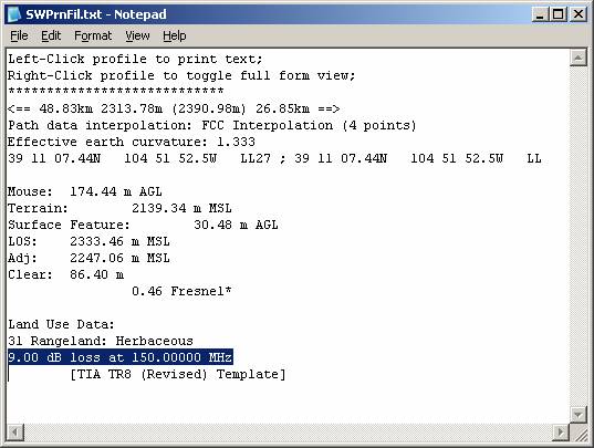
The Land Use Loss Template selected:
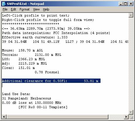
With TAP6.0.2210 or later and a Maintenance Subscription date of January 31, 2008, or later, the Mouse Location Window also includes the following information:
Additional clearance between the plotted Fresnel zone(s) and the terrain at the mouse location along the path:
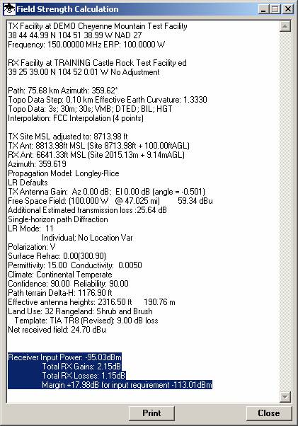
Field strength values (in dBu) computed for the "Compute Field at RX Location" and the "Show field at mouse cursor" functions converted to receiver input power (in dBm). Note for the "field at mouse cursor" function, the computed dBm value uses the same Receiver Antenna vertical pattern parameters (electrical and mechanical beam tilt) as specified for the Fixed Facility at the Receive end of the path. The actual "look angle" between the antennas will typically be different for different locations along the path. If the antenna alignment values have been set for the complete TX to RX path, the major lobe of each antenna in the vertical plane may not be aligned, so the computed dBm value (which is dependent on the antenna gain value) will not include the effects of that alignment difference):
|
|
Copyright 2007 by SoftWright LLC