Q: How do I configure TAP to read topo data from my CD or network?
A: You can set as many paths as you need for topographic data.
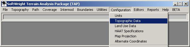
Use your left mouse button to click on the Configuration menu, then on the Topographic Data option.
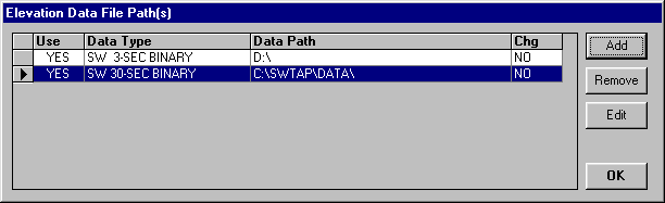
The Elevation Data File Paths form will be displayed: (Note that the screen may already contain entries for data paths as shown). (If you are using TAP 4.5 or later with the TopoScript™ indexing system enabled, the Topo Configuration is replaced with the "Index Topo Data Files" form. You should go to the TopoScript Configuration FAQ for detailed information.)
For purposes of this tutorial, we assume that your TAP program was installed in the C:\SWTAP directory. If this is not the case, substitute your TAP installation path for C:\SWTAP in the instructions that follow.
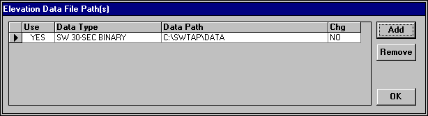
The elevation data path information consists of the following parts for each entry:
If an elevation data path definition for "SW 30-SEC BINARY" terrain data on path "C:\SWTAP\DATA" does not already exist, you must create it. If it is already defined, skip over the data file path instructions that follow.
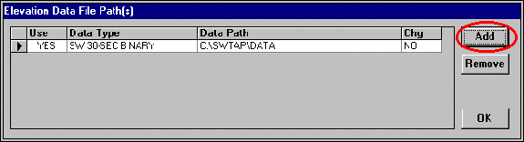
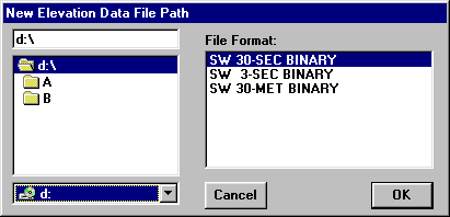
Click the Add button in the upper right corner of the Elevation Data Path screen.
The New Elevation Data File Path dialog will appear
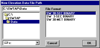
To make the program execution as efficient as possible, this form is used to specify both the location and type of data to be used.
Under the File Format side, select the type of data you want to include. (Data resolution details are included in another FAQ.)
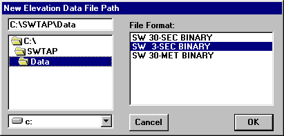
On the left side of the form, select the drive and folder where you want TAP to look for this data:
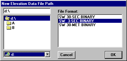
Note that if you are specifying a CD-ROM from SoftWright, you should specify the root directory of the disk, as shown above. The data files are contained in sub-folders based on the data type (A, B, C) and the latitude values. This is another mechanism to help TAP find the data as efficiently as possible when executing coverage studies, path profiles, etc.
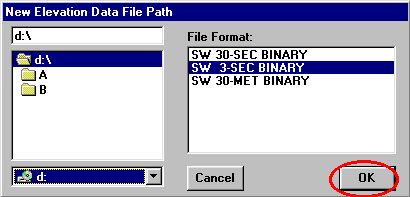
Click the OK button:
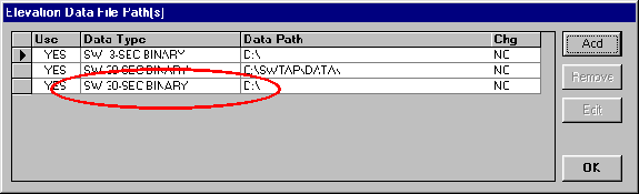
The new path information will be displayed on the Elevation Data File Pathss form:
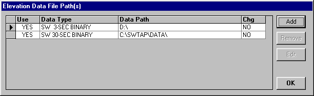
Note that new entries added are placed at the top of the list by default. TAP always searches for the highest resolution data first, (e.g., 30-meter, then 3-second, then 30-second), and the search is in the order of the list of files as shown. If you want to add a new path at a specific location in the list, first select a line by clicking on the selection button on the left end of the line.
Now use the Add button to select 30-second data on the CD-ROM:
When you click OK, the new item is added immediately after the line you had selected:
In this example, the program will first search for 3-second data (the highest resolution listed) on the CD-ROM. If the needed data is not found, it will search for 30-second data, first in thepath on drive C:, then on the CD-ROM. If you have data for the area you will be working in on a hard disk, listing that path before the CD-ROM path for the same resolution of data will enable TAP to find the data on the hard disk, which usually provides faster access than most CD-ROM drives.
Click OK to close the topographic configuration screen.
|
|