Boundary Files in 3DDisplay
Q: How can I use boundary files from TAP on a 3D image?
A: Boundary files in the .BNA format can be added to images in the 3DDisplay program ("3DD").
Boundary files in the Atlas Map .BNA format can be used in the TAP software, including files created and edited with the Boundary Line Editor, or imported from other software. These same files can be used in 3DD.
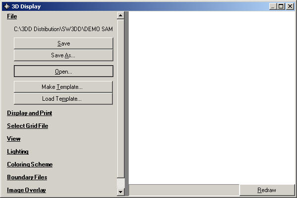
As an example, use the "Test Document" to start with a simple 3D image. (If the Test Document file does not exist you can create it as described in the "Create Document" FAQ. This Test Document file is used in several FAQ examples.)
To open the Test Document file, select the File section in 3DD and click the Open button:
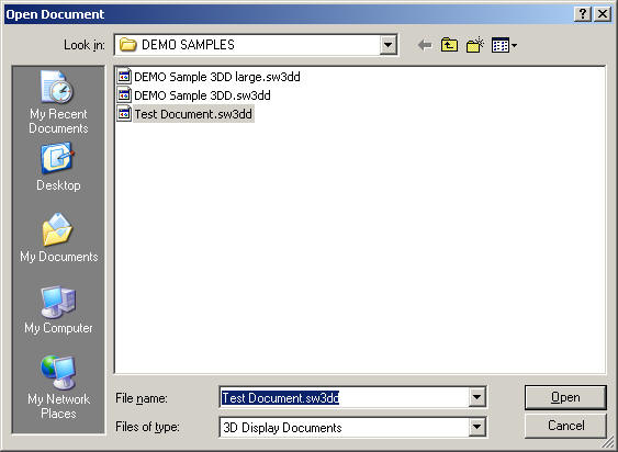
Select the Test Document file to load:
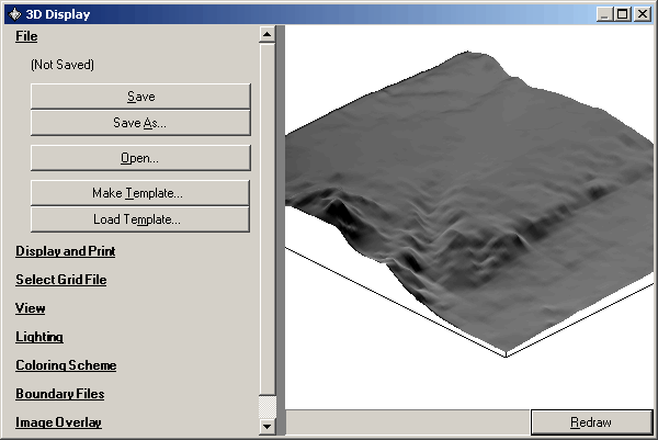
Click the Redraw button to display the image:
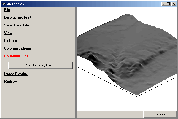
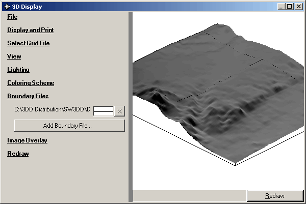
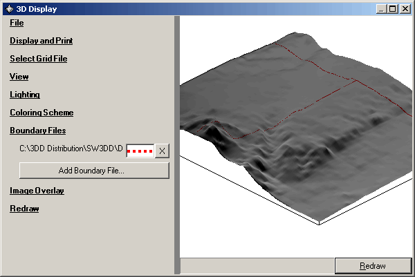
To add a .BNA boundary file to the image, click the Boundary Files section on the left side of the 3DD form:
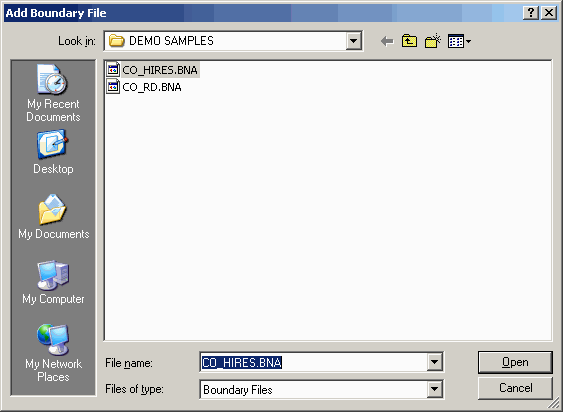
Then click the Add Boundary File button to select the file you want. For this example, select the CO_HIRES.BNA file in the DEMO SAMPLES folder. This file contains county boundaries in Colorado. (A listing of TAP BNA file names abbreviations is available in the FAQ "Boundary File Descriptions and Data Sources".)
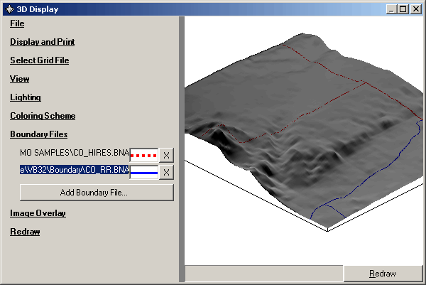
The information in the file will be displayed on the 3D image. (Depending on the Redraw setting you may need to click the Redraw button):
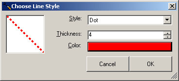
To change the line properties displayed for this boundary file, double click the box with the line (between the file name and the Remove "X" button). The "Choose Line Style" dialog box will be displayed:
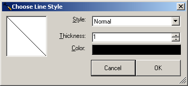
You can change the line style from the top pulldown list, the line thickness by changing the number of pixels, and the color by double-clicking on the color box:
When you click the OK button (and click the Redraw button if necessary), the new line properties are applied to the drawing:
You can add other boundary files to the drawing with the "Add Boundary File" button, and you can remove files from the drawing with the "X" button to the right of each boundary file line.
If the file name is too long to be displayed, you can click on the file name and drag the mouse to the right:
If you want to include the boundary file information in the Legend for the drawing, click the Display and Print section:
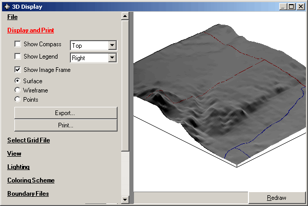
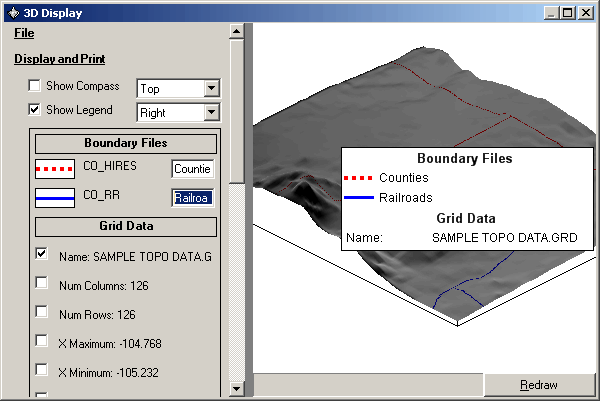
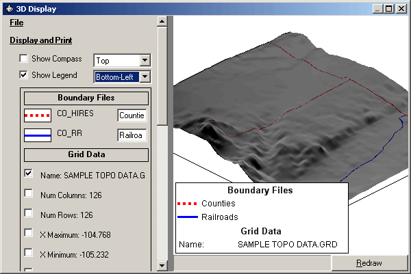
Mark the Show Legend checkbox. When the Legend information is displayed, you can edit the descriptions to show text other than the boundary file names. For example, the legend could be edited to display "Counties" and "Railroads" instead of the "CO_HIRES.BNA" and "CO_RR.BNA" file names:
You can adjust the legend of the location with the pulldown list:
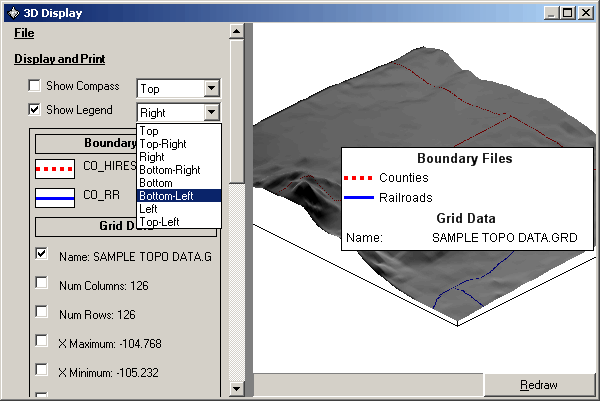
The legend will be relocated when you select the item from the list:
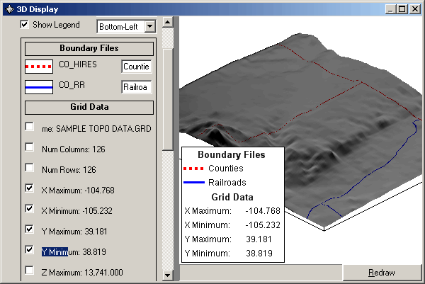
You include or remove the legend description of the elevation grid file ("SAMPLE TOPO DATA.GRD") and other information by checking or un-checking the box associated with each item:
|
|
Copyright 2003 by SoftWright LLC