Q: Can I use the Land Use files to create Surface Feature files for use in TAP?
A: Both the Land Use files and the Surface Feature files add information to the basic topographic elevation data, and both are important for creating realistic path profiles, area coverage studies, etc.
First, it is important to understand the difference between how the types of files are used in TAP.
Land Use files (from the USGS or created with the Land Used Editor in TAP) contain information about the type of use of the land, such as agricultural, forested, residential, industrial, urban, etc. The primary use of these files in TAP is to apply a user-defined loss value for a field strength calculation, based on the land use classification at the receiver location. For example, suppose the computed field value at a location is 50dBu. If the location is an open field in an agricultural area, you would expect no significant additional losses. But if the location is in a heavily industrialized urban area, the additional losses from buildings and man-made noise might make the signal unusable. The Land Use module includes the ability to assign loss values based on different use classifications as a function of frequency.
The Surface Feature files (also called Obstruction files in earlier versions of TAP) serve a different function. These files enable you to define three-dimensional obstacles at a specified location and with a specified height. These obstacles are then used in path profiles or field strength calculation by adding the obstacle height to the topographic elevation data. For example, a path that has unobstructed line of sight over a ridge in the topography might not have line of sight if 50 foot buildings are added as a Surface Feature on the topography. The addition of the obstruction will be considered in the field strength calculation. The terrain elevation values will be augmented by the obstruction height before the line-of-sight and loss calculation are computed.
In summary, the Land Use files affect the calculation specifically at the receiver location, and the Surface Feature files affect the calculation along the path.
The Land Use files do not include height information, so a classification of "Forest" does not indicate if the trees are 20 feet or 100 feet tall. Also, the Land Use files are typically on a 200 meter grid, with groupings of use classifications forming arbitrary shapes. Since the Surface Feature files require height information, and are defined as circular area approximations, there is not a convenient way to automate the conversion of Land Use information to Surface Feature files.
However, in TAP 4.4 and later, you can use the Land Use information as a guideline for creating Surface Feature files.
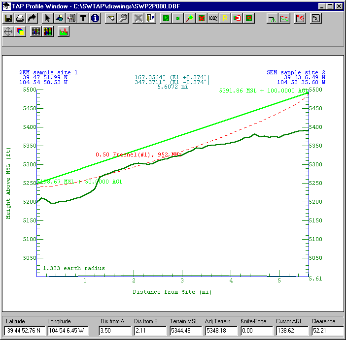
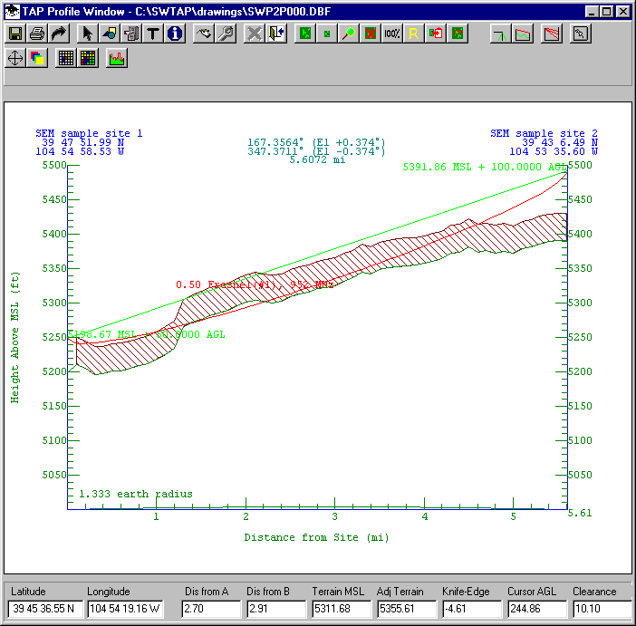
Consider an sample path profile between two specified coordinates as shown:
The path has clear line of sight, and only minimal Fresnel zone penetration. The initial evaluation would be that this is likely a usable path, even at the 952Mhz frequency shown on the profile.
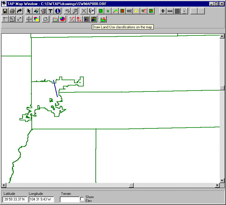
In order to determine if ground clutter might be a factor on this path, we can draw the path on a map. Then we can add Land Use information by clicking the multi-colored grid button on the Map Window toolbar:
You can define the area where you want to display the Land Use data by entering the coordinates on the Land Use Data form, or you can double click the coordinate box on the form and draw the area with the mouse, as shown:
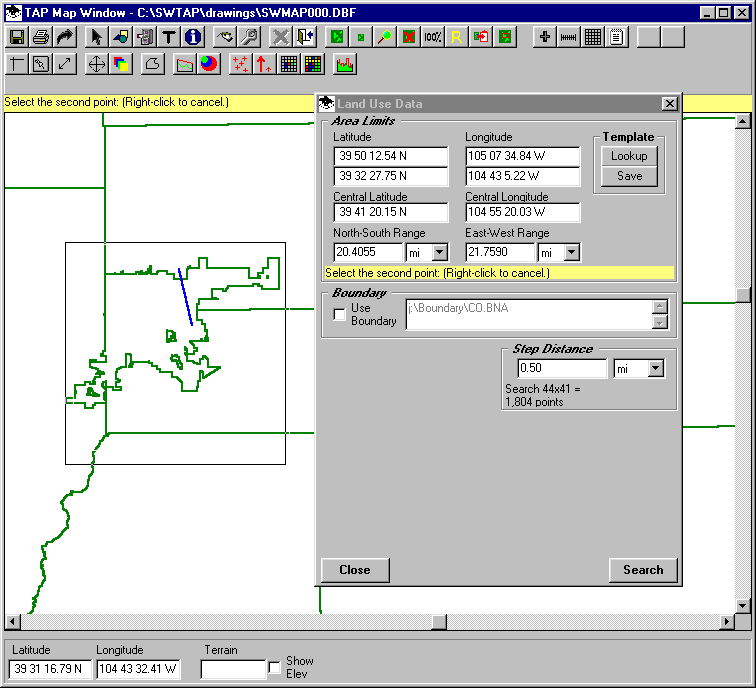
(You should usually specify just the area you want and a "Step Distance" that is reasonable for the amount of detail you need. Specifying a large area and very small step can increase the processing time for retrieving the Land Use data significantly.)
The Land Use classifications will be drawn on the map, and you will have the option to draw a legend of the values.
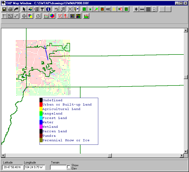
The map clearly shows that the path is through "Urban or Build-up Land" based on the USGS Land Use data.
We can use this information to define a Surface Feature object to add obstacle heights in the area.
Click the Surface Feature button on the toolbar (in TAP 4.4 and later; the icon with a green profile with red obstacles shown).

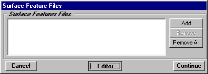
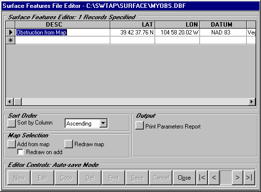
When the Surface Feature Files form is displayed, be sure the list is empty. (If you wanted to display existing Surface Feature files, you could use the Add button to create a list of files to show on the map.)
Click the Editor button on the Surface Feature Files form.
The Open File dialog box is displayed. You could use this form to find an existing Surface Feature file if you wanted to add the new obstacle to that file.
To create a new file, enter a new file name, such as MyObs.DBF and click the OK button.
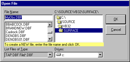
You will be prompted to confirm the creation of a new file.
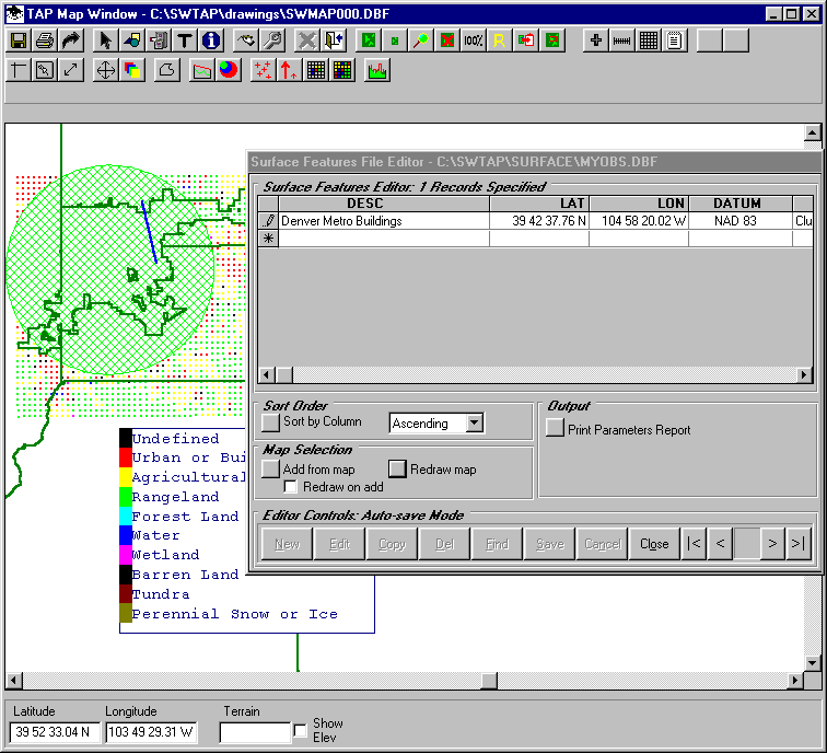
The Surface Feature editor will be displayed:
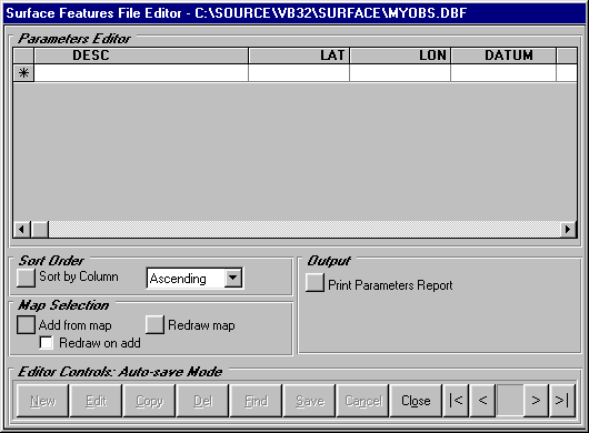
Since the TAP Map Window is displayed, the Surface Feature editor includes the Map Selection section (in the lower left part of the form).
The "Add from map" button enables you to draw an area on the map to define a Surface Feature obstacle. Click the "Add from map" button.
You will be prompted to draw an area on the map by clicking two opposite corners. Draw a box that encloses the Land Use area shown in red.
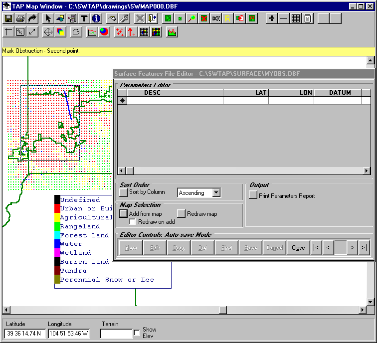
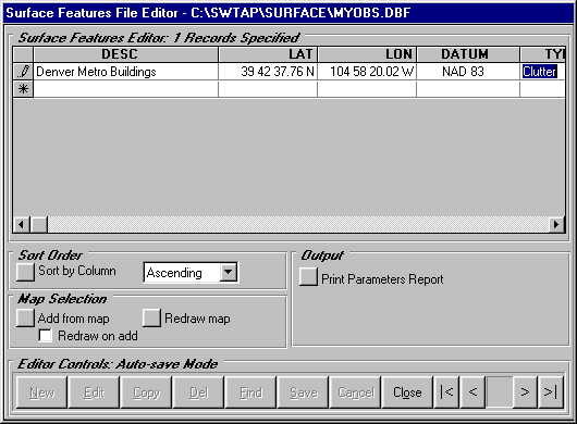
When you click the second point to define the area, the program will add an obstruction in the data base, as shown in the editor.
You can change the Description of the object, as well as the obstruction type:
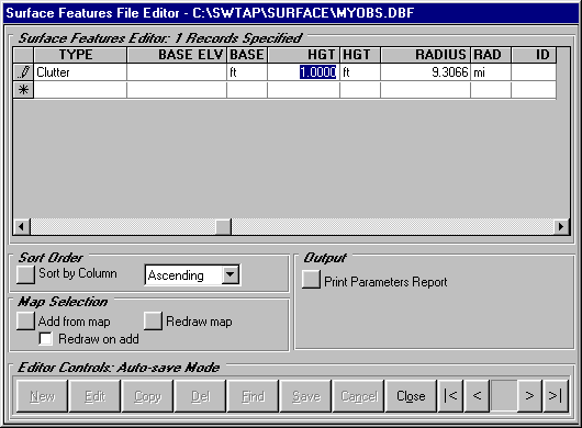
Also, be sure to change the height of the obstacle. The default value when the object is created in the data base is 1.
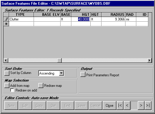
Change the height to 40 feet for the buildings in the area. (This example is for illustration only. Be sure to determine a realistic height for the obstacles you add for real situations.)
Now click the "Redraw map" button to show the obstacle on the map. (If you want to draw the obstacles immediately when you create them, you can check the "Redraw on add" box, but if you are drawing multiple obstacles this may slow down the process.)
Now that the Surface Feature obstacle (representing the 40 foot buildings in the area) has been added, you can redraw the path profile and include the Surface Feature file. The suitability of the path is now questionable based on this more complete information.
For example, even on this relatively short path, the addition of the Surface Feature file in the Longley-Rice field strength calculations, resulted in approximately 9dB additional predicted loss.
Since the obstacle has been saved in the Surface Feature file, it can also be used with any other path profiles or area coverage studies in the same area.
Copyright 2001 by SoftWright LLC