TAP Surface Feature
Files: Obstructions
Q: How do I include obstructions (such as buildings or vegetation)
on a profile or in a coverage study?
A: Obstruction information is saved in Surface Feature
files. These are data base files that can be named and organized
in whatever way is most useful for you. Typically the files are
located in a directory named SURFACE below your TAP directory,
such as C:\SWTAP\SURFACE.
(This article describes the function in TAP5 and earlier. If you are using
TAP6, see the article on TAP6 Surface Feature Files.)
The terrain elevation data base contains topographic elevation
values that can be used to compute radio propagation, including
attenuation due to terrain shielding. The surface feature data
base files supplement the topographic data with elevation information
for manmade obstructions.
File Organization
While it is possible to enter information about all obstructions
in a single data base file, this approach is not recommended.
While every effort has been made to minimize increased execution
time resulting from obstruction checking, careful organization
of surface feature files is critical.
The more obstructions there are in a file, the greater the
impact on TAP's performance, especially with the coverage studies.
The recommended approach is to organize the files by geographic
areas. For example, if you use TAP for studies of topography or
propagation in the Denver area and in the Dallas area, separate
files (e.g., SURFACE\DENVER.DBF and SURFACE\DALLAS.DBF could be
used. Putting all obstructions for the two areas in a single file
would unnecessarily degrade program performance when checking
obstructions, since buildings in Dallas rarely affect paths in
Denver. If all of your uses of TAP are in a single geographical
region (such as a metropolitan area) a single surface feature
file usually is acceptable.
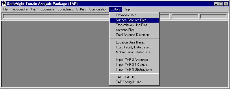
To edit or create a surface feature file with obstructions,
click on the TAP Editors menu and select Surface Features:
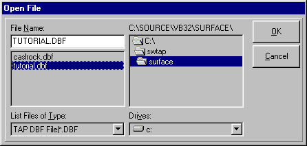
You will be prompted for the file to open. For this tutorial,
select the SURFACE\TUTORIAL.DBF file:

The Surface Features File Editor form will open:
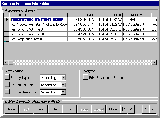
The Surface Features data bases include several items for
each record. You can use the horizontal scroll bar to move left
and right in the editor
- Description is an identifier of what the obstruction
is. You can enter a description of up to 40 characters.
- Lat/Lon/Datum specify the center of the obstruction.
- Type identifies how the obstruction is handled by
TAP. The type is selected with a pull-down list:
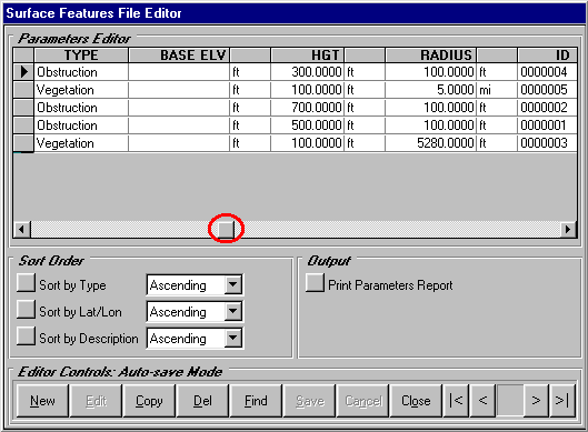
- Base Elevation is the elevation above mean sea level
(AMSL) of the base of the obstruction, such as a building. If
a value is entered, the height of the obstruction will be added
to that base elevation during profile plotting, coverage studies,
etc. If the value is left blank, the base of the elevation will
be interpolated from the terrain data when needed, and the height
of the obstruction will be added to that value.
- Height is the height of the top of the obstruction
above ground level (AGL).
- Radius is the radius from the center coordinates of
the obstruction. All obstructions are treated as cylinders (with
the given radius and height) for the purpose of defining the
area affected by the obstruction.
For this tutorial, be sure the following two obstructions
are included in the file:
|
Description |
Test Building |
Test Vegetation |
|
Latitude |
39 02 08.00 N |
39 10 50.57 N |
|
Longitude |
104 51 47.81 W |
104 51 54.28 W |
|
Datum |
NAD 27 |
No Adjustment |
|
Type |
Obstruction |
Vegetation |
|
Base Elevation |
(blank) |
(blank) |
|
Height |
300 ft |
100 ft |
|
Radius |
100 ft |
5 mi |
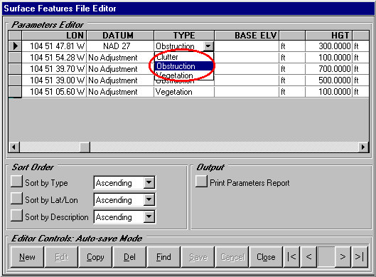
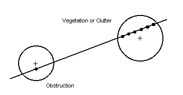
- Three types of obstructions are currently supported:
- Obstructions (buildings, water towers, etc.) are treated
as knife-edge obstructions. If the cylinder centered on the obstruction
coordinates with the given radius overlaps a path, the obstruction
elevation is added to the closest point on the path within the
radius. Only one point of the path is affected by this
type of surface feature.
- Vegetation and Clutter are "blanket" features.
If the cylinder centered on the obstruction coordinates with
the given radius overlaps a path, the obstruction elevation is
added to every point on the path within the radius. (Receiver
location elevations are not affected by obstructions. The receiver
is assumed to be based on the elevation of the terrain, plus
the receiver antenna height, and not at the elevation of any
surface feature.) In the current version of TAP, Vegetation and
Clutter are treated the same. Vegetation represents features
such as foliage, forests, etc. Clutter represents buildings,
etc.
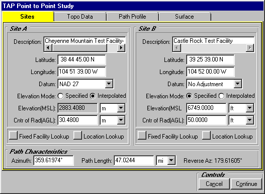
As an example, draw the profile specified in the TAP 4 Tutorial
for path profiles (click the TAP Path menu and select Path Profile
to display the Point to Point Study form):
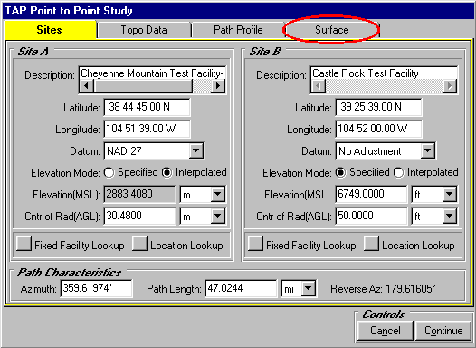
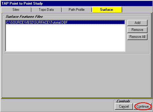
Click the Surface tab:
Click the "Add" button to select a surface feature
file:
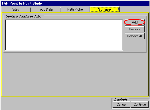
Select the SURFACE\TUTORIAL.DBF file:
Click the "Continue" button to draw the profile
with the obstructions included:
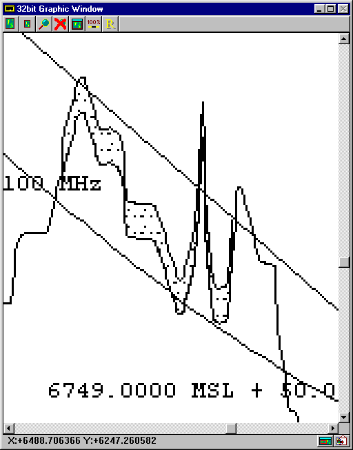
The profile is displayed showing the obstructions from the
file that affect this path:
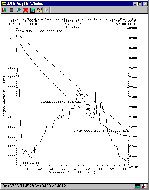
You can use the "magnifying glass" icon on the graphic
window to zoom in to see the obstructions on the path:
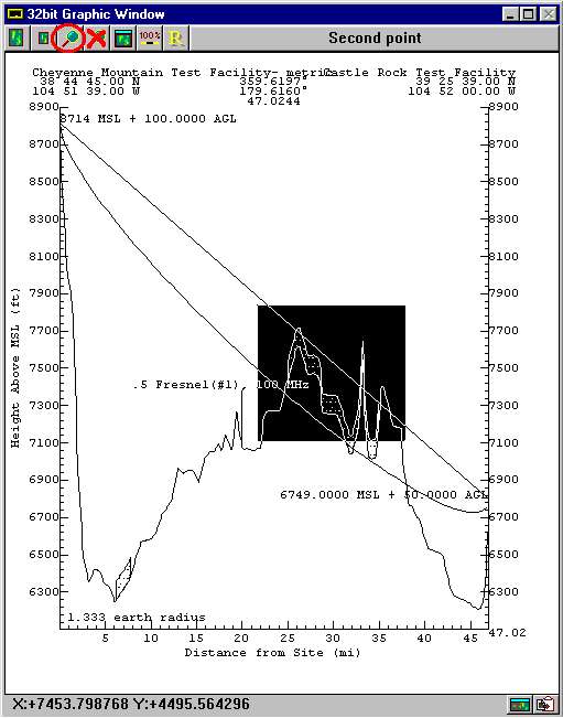
The zoom will show the obstructions in more detail:
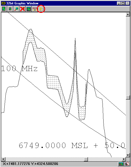
Use the "R" (Refresh) button to clarify the drawing:
Copyright 1999 by SoftWright LLC