Q: How do I set up a tile coverage study for an area that is not centered on the transmitter site?
A: The "Basic" tab of the Area Coverage Setup form allows you to set up a tile study that is centered on the transmitter site. The "Advanced" tab gives you more flexibility for setting up tile areas at any location relative to the transmitter site.
When the "Use Advanced Settings" box is checked, the Advanced tab is enabled, and the settings on that tab override the settings on the "Basic" tab.
Like the Basic tab, the Advanced tab is organized into several sections. The accessibility of some of the sections depends on the type of coverage study selected (on the Basic tab).
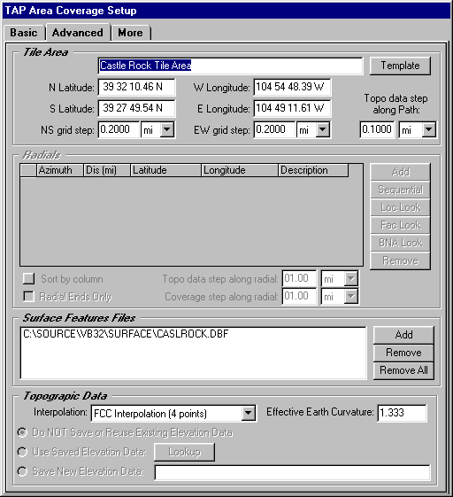
The tile study setup on the Basic tab is always centered on the transmitter site. To define an arbitrary tile area (that is, a tile area that is located anywhere and may not even enclose the transmitter site) you must use the Advanced tab. (The Tile Area section is only accessible if you have selected the Tile option in the Coverage Area section on the Basic tab.)
You can enter the limits of the area defined by the north and south latitudes, and the east and west longitudes. You can also define the north-south and the east-west grid increment independently.
The "Template" button opens the TAP Tile Template data base, where you can define frequently used tile areas, such as the areas enclosing you most important service areas, etc.
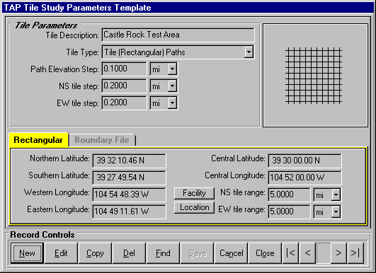
The Template option is especially important for studies you want to combine using the TAP Aggregate Coverage options (best server, simulcast, etc.) to ensure that the tile areas are identical for the studies to be combined.
The Advanced tab also includes other functions.
Surface Feature Files
Use the "Add" button to lookup TAP Surface Feature files that can contain obstructions, vegetation, etc., to be used in the study.
Topographic Data
The Basic tab uses FCC four-point interpolation (described in the TAP Technical Reference Manual) to interpolate the required elevation data points from the topographic data files. You can select one of the other interpolation methods using the pulldown list. You can also set an effective earth curvature value.
Copyright 2000 by SoftWright LLC