Mapping Image Files Online
Q: How can I find topo maps and other images to use with HDMapper?
A: There are several web sites where you may be able to find map image files.
Note that all values in this example are for demonstration purposes only. You should determine appropriate settings for your application.
A U.S. Geological Survey (USGS) site lists a number of other map sources.
One of the sites referenced by the USGS site is the Microsoft Terraserver site.
After downloading the image files you may need to use the SoftWright Image Viewer program to create the world file required to load the image into HDMapper.
As an example, you can download files from Terraserver as follows:
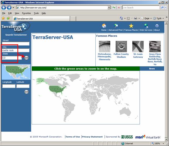
First, you can enter a city or a city and state, or you can enter a latitude and longitude, or you can click on the map on the Terraserver site. For example, to find a map in the area of Castle Rock, Colorado:
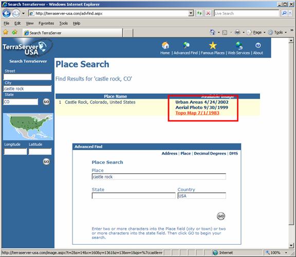
A list of the types of image files available is displayed. Click on the type you want to download:
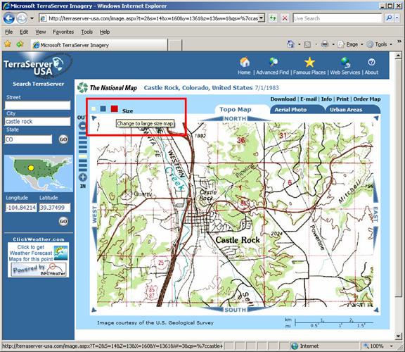
You can adjust the size of the map with the “Size” buttons:
You can adjust the resolution of the map with the zoom bars:
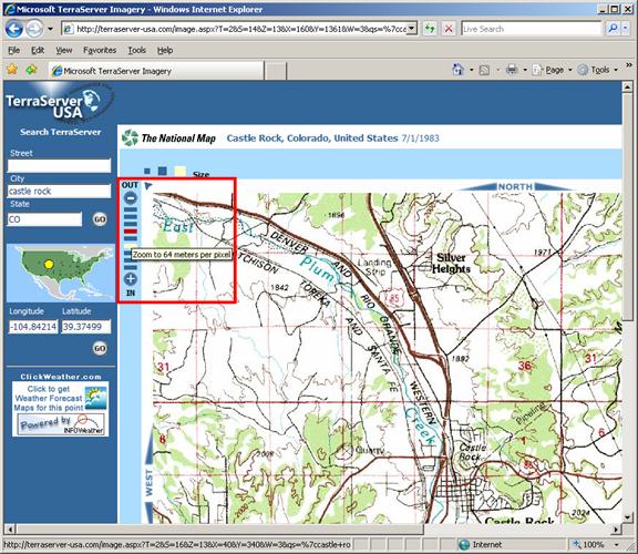
You should experiment with different settings for the size and resolution to determine which configuration(s) are best for your application.
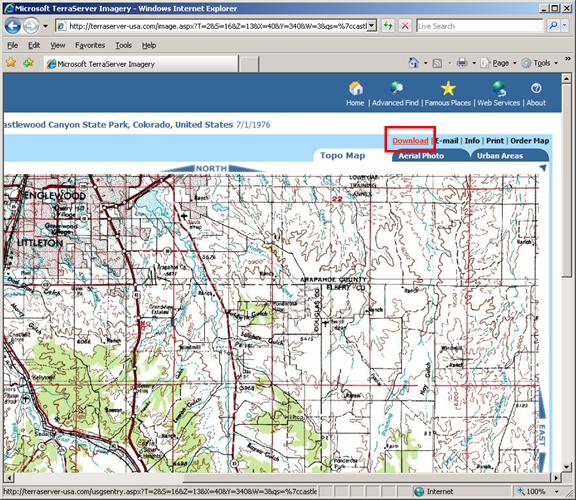
To create an image to save to your local machine, click the “Download” menu:
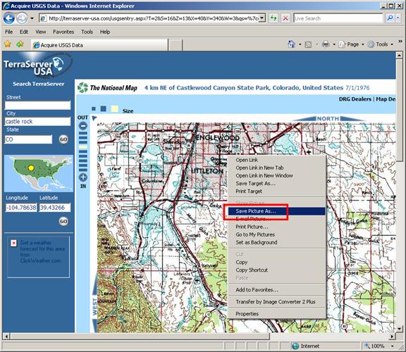
If you click the map (as described below) without first creating the downloadable image, you will only save a part of the image.
When the download image has been created, right-click the map. On the popup menu that is displayed, click “Save Picture As…”
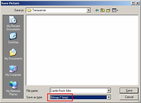
Select a folder and assign a file name for the image file. For use with TAP you should select the .BMP format):
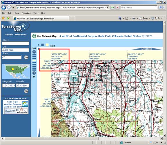
After the image has downloaded, you need to determine the coordinates of the corners of the image. This information is necessary if you want to use the SoftWright Image Viewer program to create a world file that is necessary to use the image in HDMapper. (The world file created by the function in the Terraserver menu is not compatible with the files used in TAP.) Click the “Info” menu:
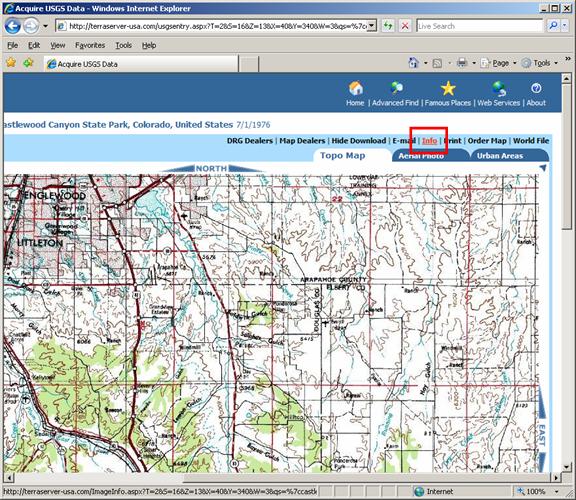
When the info image is displayed, make note of the latitude and longitude of the upper-left corner. These values can be used in the SoftWright Image Viewer to create the world file.
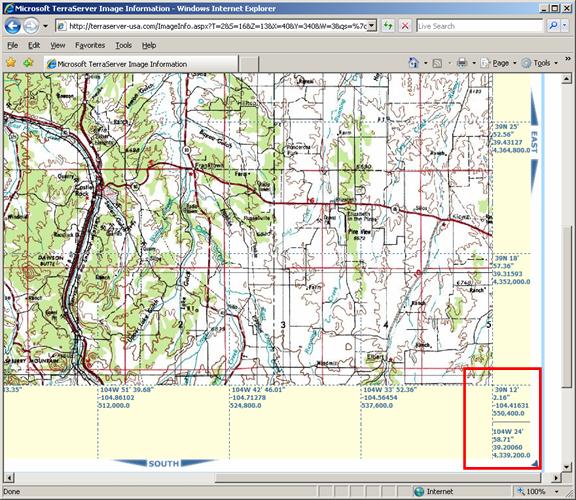
Also note the coordinates of the lower-right corner of the image:
After the image has been saved, and you have recorded the coordinates for the upper-left and lower-right image corners, you can use the Image Viewer program to create the world file required to load the image into HDMapper.
|
|
Copyright 2010 by SoftWright LLC