Land Use Files and Okumura Area Types
Q: How can I use Land Use data to set the Okumura Area values in a propagation study?
A: The Land Use module includes the Land Use Loss Editor, which can be used to correlate each USGS Land Use Classification with a particular Okumura Area Type.
Note that all values in this example are for demonstration purposes only. You should determine appropriate settings for your application.
The Land Use module in TAP uses the USGS Land Use Land Cover (LULC) data (or user-created files) to determine the type of environment (such as forest, agricultural, urban, etc.) at desired locations for a coverage study. The classifications are defined by the USGS.
The Okumura propagation model includes a variable for the Area type (such as Large Urban, Suburban, Open, etc.) that is used to adjust the predicted field strength at each location.
By default, the Okumura model uses a single Area type for all locations in a coverage study. The Area type is specified in the Okumura propagation template selected for a study.
If an Okumura study is setup including the “Use Land Use Data” setting in HDCoverage, the Area type at each location can be determined from a database that is user-configurable.
Since there is no standardized definition relating the Land Use classifications and the Okumura Area Types, TAP provides an editor to enable you to set the correlations you believe are most applicable to your engineering designs.
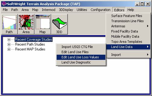
To launch the editor, select “Edit Land Use Loss Values” from the Land Use Data item in the TAP Editors menu:
The Loss DB Editor will be displayed, showing the Land Use Loss Database records.
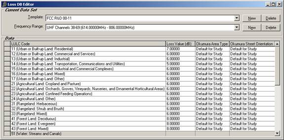
Use the pulldown list to select the Land Use Loss Template you want to edit:
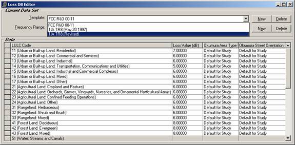
You can also create a new Template. Different Templates can be used for different types of coverage studies or other variations that are useful in your design work.
Select the frequency range you want to edit for the Template:
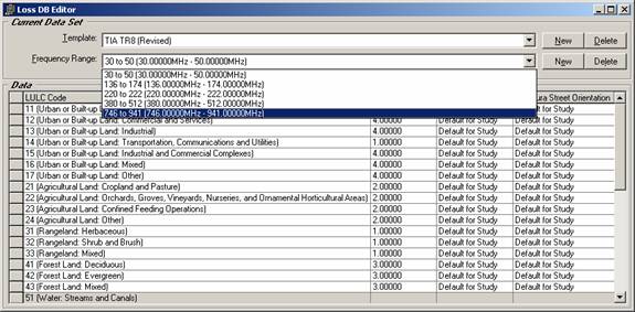
The editor displays the records associated with this frequency range for this Template:
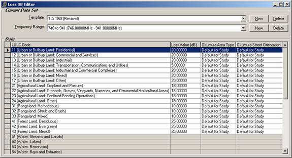
Note that a Template does not necessarily include all frequency ranges, or all land use classifications in a frequency range, as shown in the last lines in the display.
The Land Use Loss record values are described below:
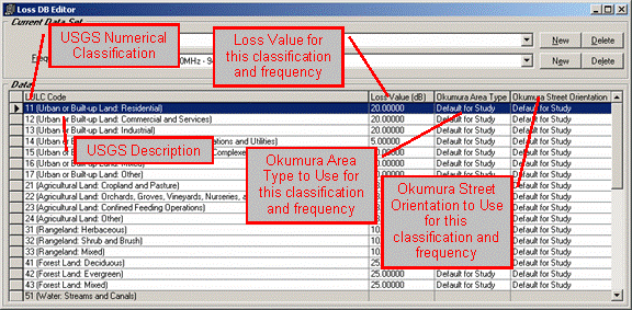
Note that the initial values for the Okumura Area Type and for the Okumura Street Orientation are set to “Default for Study”. This setting causes the program to ignore the Land Use Classification and use the setting from the Okumura Propagation Model Template selected for the study.
TAP versions before TAP6.0.2177 used the Okumura Area Type of “OPEN” for the initial Area Type. If you want the later version of this database you can download it from the SoftWright web site. (If you have already edited your Land Use Loss Database you should not download the replacement file unless you understand that your earlier edits will be lost.) Download the file into the LULC folder under the folder where TAP is installed.
You can change the Okumura Area Type and the Okumura Street Orientation associated with a Land Use Classification for a frequency range in a selected Land Use Loss Template using the pulldown list for the values:
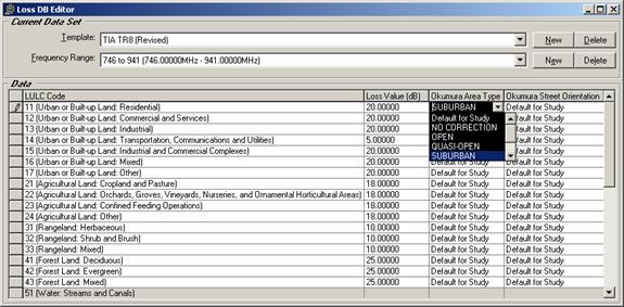
When you close the editor, the new settings will be used when you specify the Okumura Propagation model and include the use of Land Use data.
|
|
Copyright 2007 by SoftWright LLC