Multiple Path Profiles in Google Earth
Q: How can I show profiles for multiple paths for a project?
A: You can use the HDPath functions to export the paths to JPEG files or to KML files for use with Google Earth.
(This article assumes you are using TAP6.0.2342 or later and a Maintenance Subscription date of June 30, 2010, or later. Some of the functions described in this article may not be available in earlier versions or with expired Maintenance Subscription.)
Note that all values in this example are for demonstration purposes only. You should determine appropriate settings for your application.
For example, suppose you have two paths associated with a particular project. You can draw the paths in HDPath:
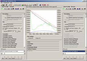
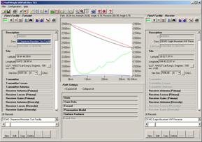
You can save each of the profiles to a JPEG file then use those images in other documents, such as Word, PowerPoint, etc.
You can also export the profiles to a Google Earth KML file, each profile to a different KML file name. Then you can load the multiple-paths into Google Earth to display them. The KML file will usually load automatically from HDPath. If you want to add a previously created KML file, double-click the file in Windows Explorer:
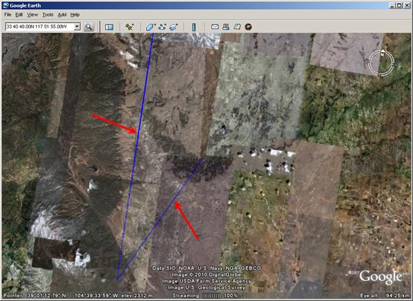
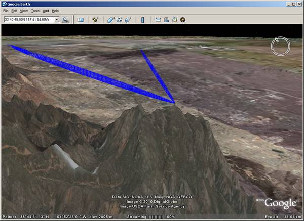
You can use the zoom, pan, and tilt functions in Google Earth to examine the paths:
|
|
Copyright 2010 by SoftWright LLC