Global Land Cover Data File Locations
Q: How do I install Global Land Cover data files for use with TAP?
A: With TAP6.0.2203 or later, the Land Use module, and a Maintenance Subscription date of December 31, 2007, or later, you can use Global Land Cover (GLC) data files with TAP.
Note that all values in this example are for demonstration purposes only. You should determine appropriate settings for your application.
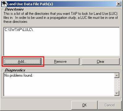
Global Land Use data files (with a .GLC file extent) can be copied into any folder. Then use the TAP Configuration menu to add that folder to the list of directories for Land Use files (the same list that is used for USGS Land Use (.LUC) data files.
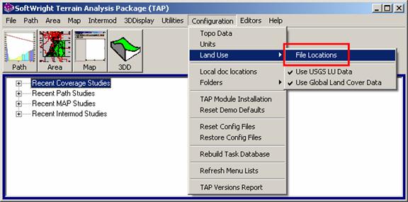
On the TAP6 menu form, click the Configuration menu, then click “Land Use”, then “File Locations:”
On the “Land Use Data File Path(s)” form click the Add button:
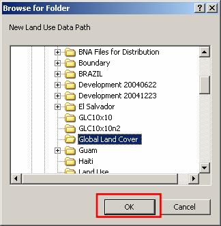
Navigate to the folder where you copied the .GLC files and click OK:
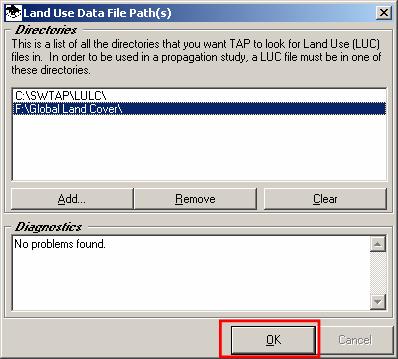
The new path will be added to the list:
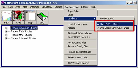
By default TAP uses both USGS Land Use data files and Global Land Cover files. (The USGS files, based on a 200-meter grid, are better resolution than the 30-arcsecond, or “1km” GLC files). The program searches for the value at a desire location, first looking for the USGS file, and, if it is not found, then looking for the GLC file.
You can change the default configuration from the TAP6 Configuration menu. The Land Use section of the menu includes items for “Use USGS LU Data” and “Use Global Land Cover Data.” The check mark by each entry indicates it will be used. You can click either entry to uncheck it and that data type will not be used for Land Use information.
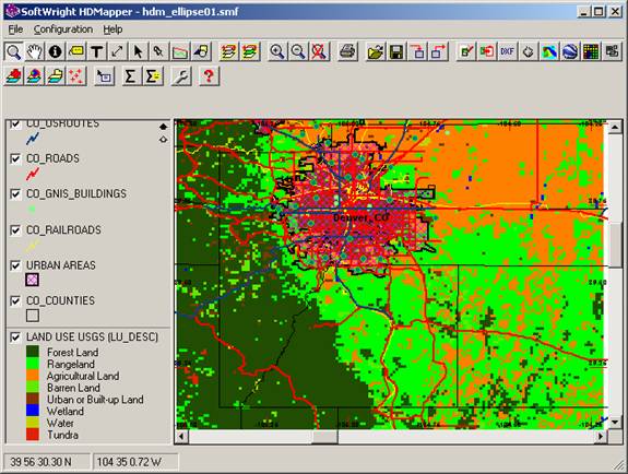
For example, the USGS Land Use data in the area around Denver is shown below.
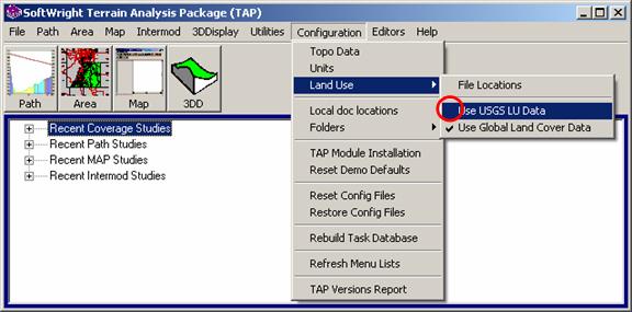
If you uncheck the “Use USGS LU Data” option in the Configuration menu, the USGS data will not be used, and only the GLC data will be used:
Now the map can be drawn showing only the GLC data values.
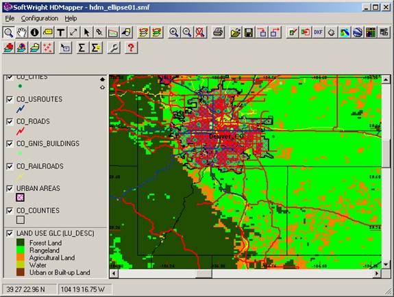
Note that the legend shows the USGS Land Use classifications. The values in the Global Land Cover data files have been associated with the USGS values.
All Land Use functions (path profiles, area coverage studies, map layers) are affected by the settings in the Configuration menu.
|
|
Copyright 2007 by SoftWright LLC