Q: How can I find the elevation of a potential transmitter site I am considering?
A: You can enter the coordinates of the site and use TAP to get the elevation from the topographic data files.
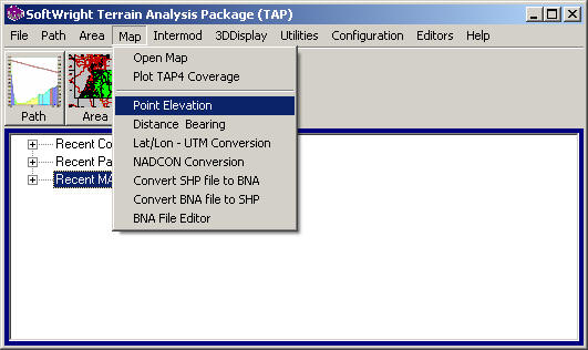
From the TAP6 Map menu, select "Point Elevation".
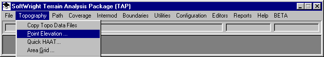
If you are using TAP5 or earlier, the menu will appear as shown below, using the Topography menu:
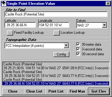
This will display the Single Point Elevation Value form:
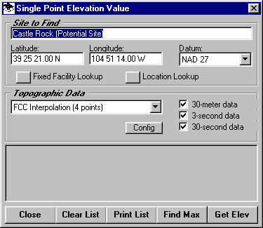
You can enter a description of the site (only necessary if you want to enter several sites and later print the results), as well as the latitude, longitude, and datum of the site.
The Fixed Facility and Location lookup buttons enable you to get the coordinates from a record you previously entered in one of these data bases.
You can select the interpolation method to be used to interpolate the elevation at your location from the grid of elevations in the topographic data files.
You can select the data resolution you want to use (30-meter, 3-second, 30-meter) to find the elevation. Typically you would include all of the data resolution types you have available for the area. You can use the Config button to ensure that your TAP system is properly configured to search for the topographic data files in the correct folders.
The "Get Elev" button will start the search of the topographic data files and display the results:
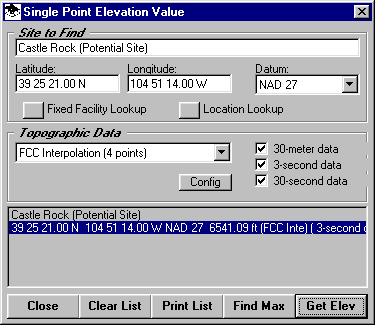
You can find change the coordinates to find the elevation of other sites using the "Get Elev" button.
The "Find Max" button can be used to search in the immediate vicinity of the site you have specified to locate any higher elevations. If you click the "Find Max" button, the Find Maximum Elevation form is displayed:
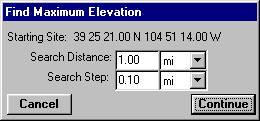
You can specify the distance and interval you wish to search. The results will be displayed, and you will have the opportunity to change the previous coordinates to this new location:
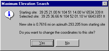
If you answer Yes the new (higher) coordinates will be returned to the Single Point Elevation form:
|
|
Copyright 2000 by SoftWright LLC