Q: How can I use a TAP coverage study in another mapping program that requires UTM coordinates instead of latitude and longitude values?
A: When you run a coverage study in TAP, the locations of the field calculations and the computed field values are stored in a dBase file (Rxxxxxxx.DBF) with the latitude, longitude, field value, as well as other information about the results. In TAP 4.4 and later you can export the information into a new .DBF file with the locations converted to UTM coordinates.
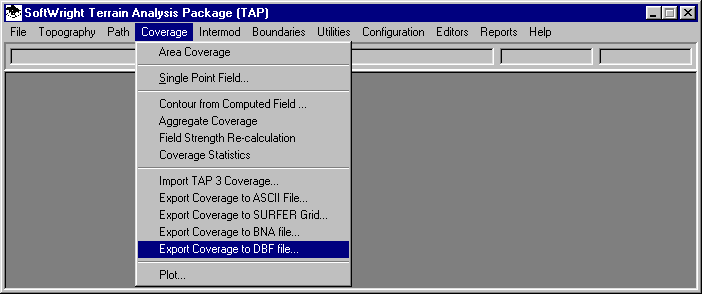
After the study has been completed, open the Coverage menu and select "Export Coverage to DBF File"
When the Select TAP Task form is displayed, select the task you want to export:
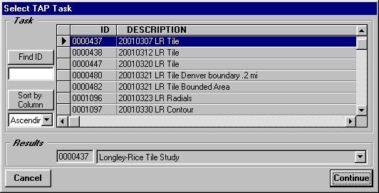
Click the Continue button.
When the Export Coverage form is displayed, pull down the list of X-Y units and select UTM.
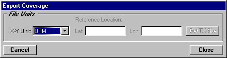
Click the Close button.
On the Output File to Write form, enter the name of the new DBF file you want to write.
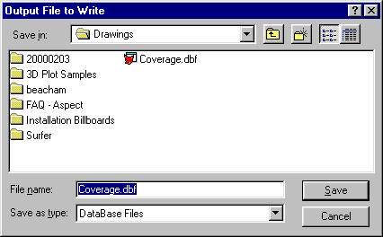
The file will be written with UTM coordinates for the X and Y values. The file can then be imported into other software with those coordinate values.
Copyright 2001 by SoftWright LLC