Coverage Contours in
Maptitude
Q: How can I draw a TAP coverage contour in Maptitude?
A: You can export a coverage contour from TAP to a
.BNA file, which can then be imported into Maptitude.
(If you want to import a tile or radial study from TAP into
Maptitude, see the document Importing TAP Field Strength Studies into Maptitude.)
After you have completed the coverage contour calculation in TAP, select
the Coverage menu, then select Export Coverage to BNA File:
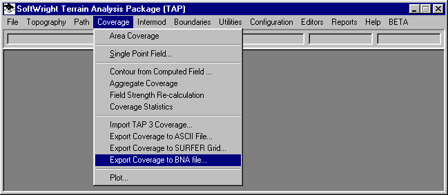
The Select TAP Task form will be displayed.
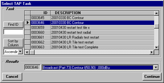
Select the coverage contour you want to export to Maptitude
and click the Continue button.
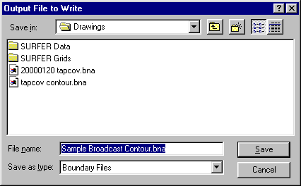
You will be prompted for a file name. Enter the name for the
.BNA file you want to write:
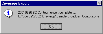
A progress bar will be displayed as the file is created.
When the export is complete, a confirmation form will be displayed:
Now you can exit from TAP and start Maptitude.
To draw a .BNA contour in Maptitude:
- Create a new map in Maptitude, usually for the state where
the study is located.
- In the Maptitude menu, click File, then click Open.
- From the "Files of Type" pulldown list, select
Atlas BNA.
- Use the Browse function to find the BNA file you created
from TAP.
- Click Open.
- The Import Atlas BNA File form is displayed. Click OK to
accept the default values.
- Enter a name for the Maptitude .DBD map layer file that will
be created. This could be the same file name used for the BNA
file, but with the .DBD file extent. Click the Save button after
you have entered a new file name.
- Several status bars will be displayed during the conversion
process.
- The contour will be opened as a map by itself.
- Click on the original state map to select it.
- From the Maptitude Map menu, select the Layers option.
- Select Add Layer.
- Select the .DBD map file you just created and click Open.
- Your file now is displayed in the Layer List.
- You can select the Move Up or Move Down buttons to adjust
where your boundary file will be displayed in the order of the
drawing layers.
- You can use the Style button to edit the line style, color,
and other attributes of the contour line.
- Click Close.
- The contour is now displayed on the state map.
You can also use a contour drawn in Maptitude to get an estimate
of the pollution contained in the contour.
Copyright 2001 by SoftWright LLC