Fixed Facility Site Elevation
Q: Why did the Fixed Facility site elevation portion of the lookup form change?
A: The site elevation portion of the Fixed Facility lookup form was changed with TAP 4.5.922.
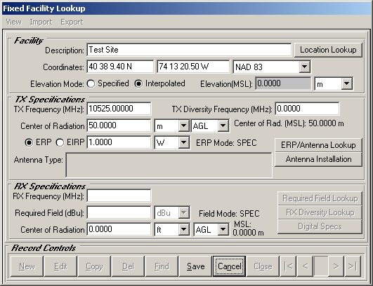
In earlier versions of TAP, the site elevation portion of the form included option buttons for the Elevation Mode:
If the Specified option was selected, you could manually enter the elevation of the site from other information, such as a station license, a map, site survey, etc.
If the Interpolated option was selected, the program tried to find the elevation of the site (based on the site coordinates shown) and displayed the elevation value.
If the topo data files for the area were not available and the site elevation could not be found, a warning message was displayed:
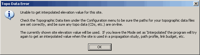
The message was also displayed anytime the record was displayed, such as when you were scrolling through records.
To eliminate the repeated display of this warning message and to give users more control over the site elevation value in the database, TAP 4.5.922 changed the appearance as shown below:
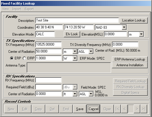
The Elevation Mode option buttons have been replaced with a label indicating if the elevation value is specified ("SPEC") or interpolated from the topo elevation data files ("CALC"). This label is read-only and cannot be changed directly.
The "Elv Look" button has been added.
The behavior of the new label and button is as follows:
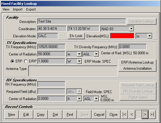
The new version only searches for elevation values from the topographic data files when you click the Elv Look button. This eliminates the delay scrolling through records, and the warning message for sites when the elevation is not found.
Copyright 2003 by SoftWright LLC