Q: How do I use the USGS Digital Line Graph files with TAP?
A: TAP 4.2 includes the ability to include DLG files on map plots. These files are currently available from the U.S. Geological Survey at
http://edcwww.cr.usgs.gov/Webglis/glisbin/searchchoiceftp.pl?dataset_name=100KDLG
These files from 1:100,000 scale maps have MUCH more detail and information than our BNA files (still supported) that were mostly based on 1:2,000,000 maps. This also means that you can easily create 100Mb graphics files that take a while to draw. (For more information on downloading files from the USGS site, see the USGS DLG File Sources FAQ.)
On the USGS web site you can find files graphically, or by state or map name, with each area including several categories. The "Transportation" category includes roads down to the neighborhood street level. Be sure to download the USGS "Optional" format files. Also be aware that DLG files typically do not contain text information (street names, county names, etc.). You can draw the picture but there is no text information to identify particular objects.
You will also need a way to extract the files from the GZIP format (not PkZip) such as WinZip (from www.winzip.com).
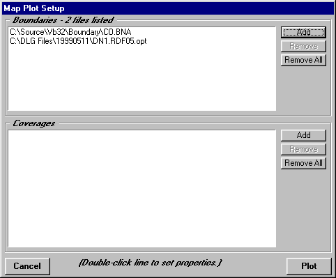
Once the files are un-compressed (typically with the extension .OPT, for the "Optional" format), you can bring them into TAP just like you have used BNA files in the past:
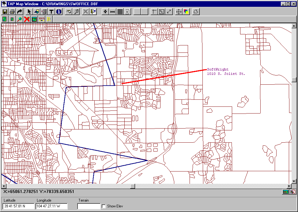
The maps will contain much more detail than with the more general BNA files supplied with TAP. For example, the blue line in the drawing below is part of the outline of Denver in the CO.BNA file:
Copyright 1999 by SoftWright LLC