Map Scale in HDMapper™
Q: Can I draw a map scale in HDMapper?
A: Since HDMapper uses shapefiles which typically use units of degrees of latitude and longitude, HDMapper does not currently support drawing a scale.
One of the strengths of HDMapper is the use of the industry-standard ESRI Shapefile format. In order to promote compatibility, most shapefiles are created using degrees of latitude and longitude as the units in the file. This standardization eliminates confusion and conflicts between different map projections, datum references, spheroids, etc.
One consequence is that the linear scaling in the north-south and east-west directions is not equal. For example, an area in Colorado that is one-degree by one-degree will display as a square on the screen. But (depending on the latitude of the area), the actual dimensions are approximately 111 kilometers by 87 kilometers.
This is the reason why a plot of radials (normally a circle) displays as an ellipse.
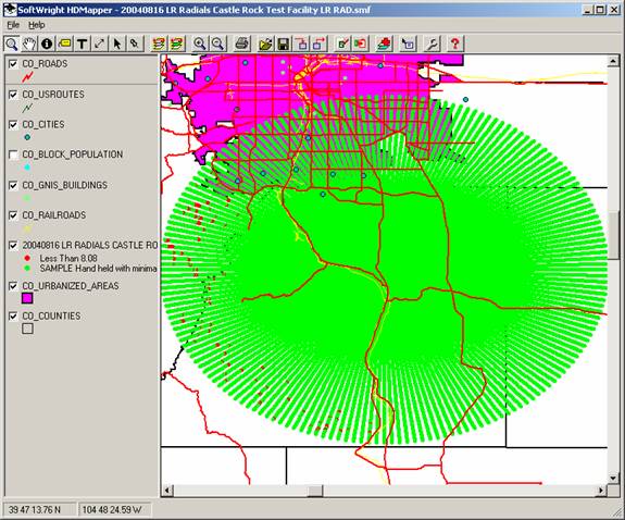
In this case the 20-mile radials, plotted on the latitude-longitude units, appear as different lengths. However, since all the shapefiles are using the same latitude-longitude reference, the coverage area is accurately represented. However, a conventional map scale as used on maps printed with a specified projection cannot be depicted on a plot using units of latitude and longitude.
You can use the Distance Calculation button to measure the distance between points you select on the map.
|
|
Copyright 2004 by SoftWright LLC