
Q: How can I enter elevation data manually for a path if I do not have the topographic data for the area?
A: You can force TAP to create a file for the path, then enter the elevation values for the points along the path.
First, use the Path menu and select "Path Profile":

This will display the form to define the end points of the path.
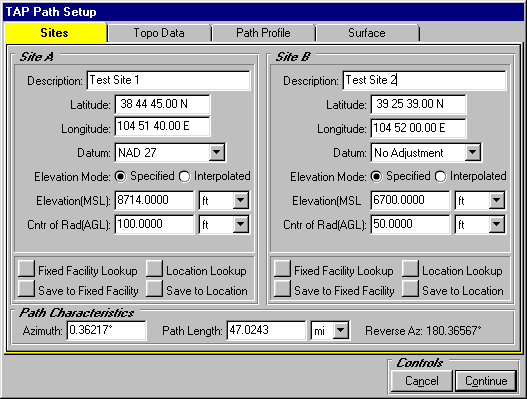
Enter the end points of the path and the "Specified" elevation of each of the end points. You can use the Fixed Facility Lookup to read the paths from the Fixed Facility data base, or to enter the site information into the data base for use later.
Click the "Topo Data" tab on the form.
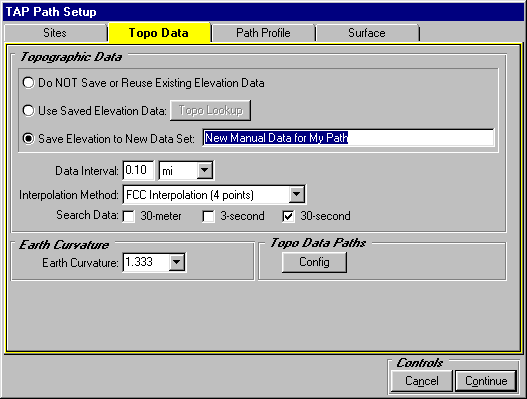
On this tab, select the option to "Save Elevation to New Data Set" and enter a description for the data. The description will be used later when you want to retrieve the data after you have entered the elevation values manually.
Set the Data Interval to the value you want to use to enter the elevation values along the path. TAP will create a data file to hold the elevation values at this interval along the path. You will later edit the file to fill in the elevation values.
When the form settings have been made, click the "Continue" button.
TAP will create the elevation data file for the path and will try to find the elevation values for the path, but if the topo data files are not found, the program will display a warning message:

(Note you can also use this approach if only a portion of the topographic data is available, or if you only have 30-second low-resolution data and want to create the file and then edit the elevation values with more accurate values from a map.)
If the warning is displayed, click "OK" to close the message.
Now to edit the path values, use the Editors menu and click "Elevation Data":

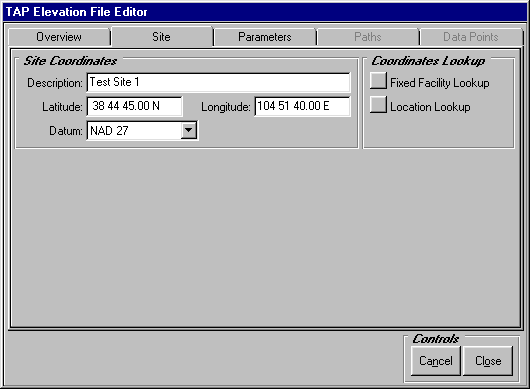
When the Elevation File Editor is displayed, click the Site tab and enter the site used for the beginning of the path (Site A on the Path Profile form):
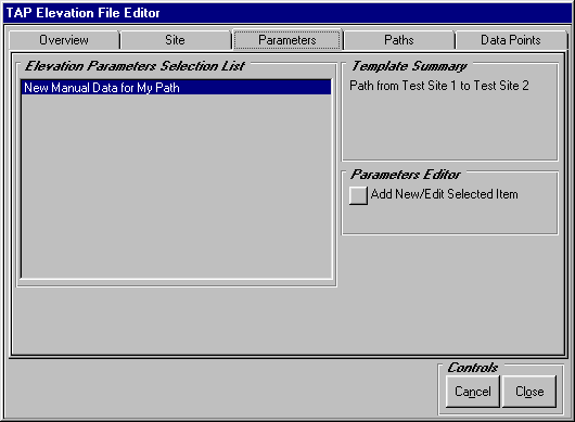
Then click the Parameters tab. If more than one set of data exists for this path, they will be displayed on this tab. Select the data set you created with the Path Profile program.
Then click the Paths tab on the form. If more than one path exist for this site, the azimuth of each path will be displayed on this tab. Select the path you want to edit.
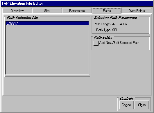
(Note you can also add a new path from the site with the Add New button.)
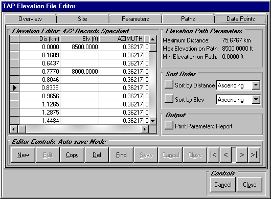
To edit the elevation values, click the Data Points tab. The distance and elevation values will be displayed for this path. If no elevation values were found by the Path Profile program, the Elevation value will be blank. You can enter the known elevation value from a map or other source.
After you save the file, to use this elevation data to plot the path profile, on the Topo Data tab, select "Use Saved Elevation Data"
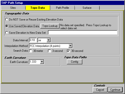
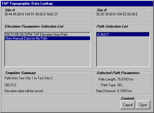
Then click the Topo Lookup button to select the Data Set and Path azimuth you want to use for the profile plot.
Copyright 2000 by SoftWright LLC