Q: When I set up a coverage study in TAP, the plot always defaults to the level of the mobile unit for that study. How can I keep the multiple levels and colors I want to plot as the default?
A: In TAP 4.4 and later, you can select whether or not to use the mobile unit required field as the default. If you select not to use the value for that study for the plot, the levels and color settings from the previous plot will be used. This enables you to set multiple levels represented by different colors to use for all of your radial and tile study plots. (Contours are always computed for the mobile receiver required field value specified in the study.)
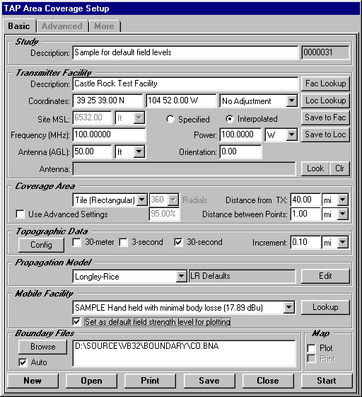
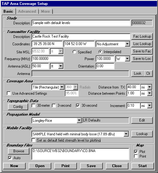
When you set up a coverage study, one of the required parameters is the mobile unit information (from the Mobile Facility database in TAP):
The mobile facility information includes the mobile receiver height (used for calculations by most of the propagation models for line-of-sight and Fresnel zone clearances), as well as the required field for that mobile unit. In the example above, the Mobile Facility record shows a required field value of 17.89dBu. (All values used in this example are for illustration only. It is important that you determine the appropriate values for your equipment and application based on good engineering judgment.)
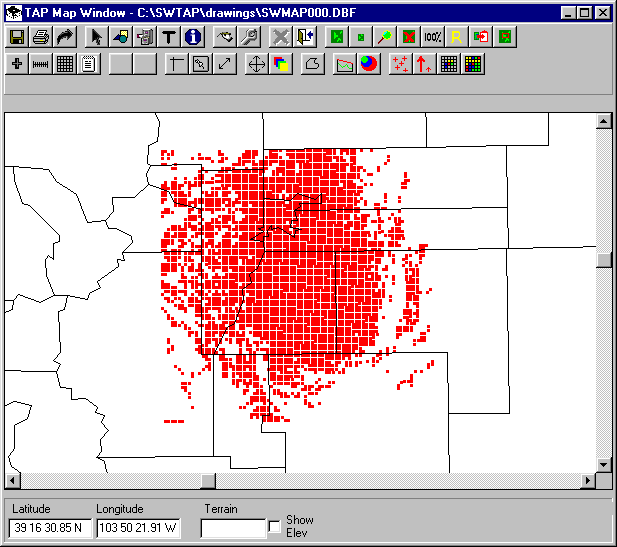
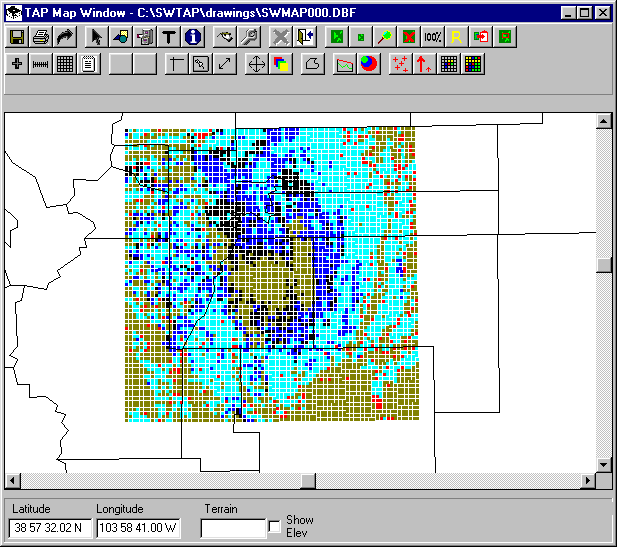
In earlier versions of TAP (and in TAP 4.4 and later, if the "Set as default field strength level for plotting" box is checked as shown above), the coverage map plotted from this study would show the computed field locations where the value was equal to or greater than that minimum threshold:
You can also plot the map with different field strength levels shown in different colors, using the Levels button on the Map Plot Setup form:
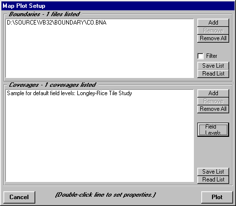
When you click the Levels button, the Levels form is displayed:
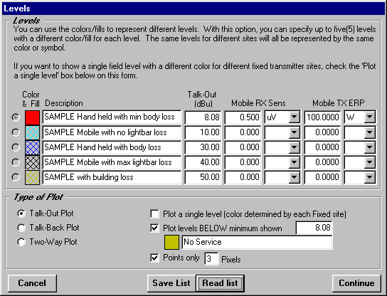
This form is used to set different levels, based on different mobile receiver configuration, different environmental conditions, etc.
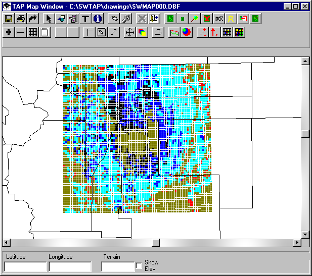
With the different levels set, the same coverage map shows area of different field strength:
If you want these levels to be used as the default values for future tile or radial plots, un-check the "Set as default field strength level for plotting" box on the Area Coverage Setup form as shown:
This is especially useful when used in conjunction with the TAP 4.4 AutoPlot function, so that the coverage map will be drawn with the multiple field level defaults automatically when the calculations are completed:
Copyright 2001 by SoftWright LLC, Aurora, Colorado, USA