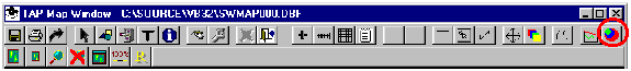
Q: How can I get a quick calculation of field strength on a map plot?
A: When the Map Window is displayed, you can click the "Field Strength Preview" button to select a path to plot.
The Field Strength Preview form will be displayed:
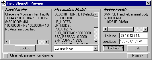
You can use this form to select the base station from the Fixed Facility Data Base, the propagation model and parameters, and the mobile unit from the Mobile Facility Data Base.
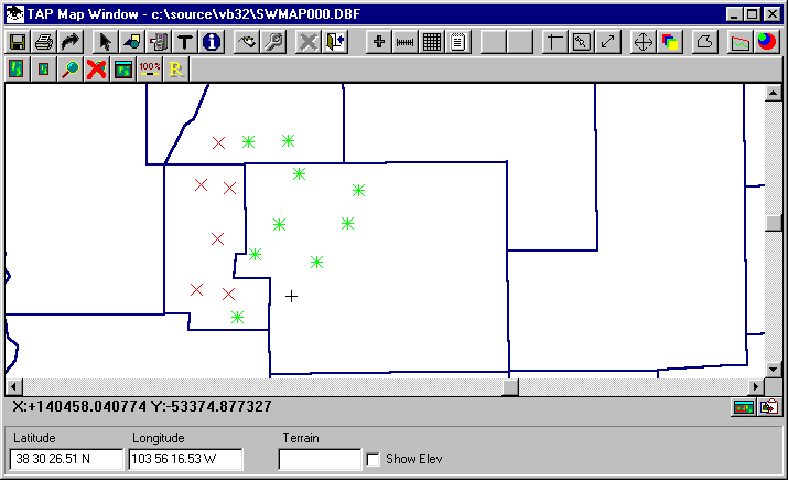
When the parameters are set, and the Field Strength Preview form is active (the form’s title bar is highlighted), clicking on the map will establish a mobile location. The path elevation data will be retrieved and the field strength value will be computed. If the computed value is higher than the required value for the specified Mobile Facility, the point will be marked with a green asterisk. If the value is lower than the required field, the point will be marked with a red "X" mark.
You can expand the form to view the details of the calculation. The information presented will depend on the selected propagation model. The end of the listing for each calculation will display the computed net received field strength at the location. You can also clear the listing or print the information.
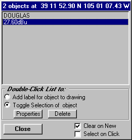
You can use the "ID" function from the toolbar and click on a point to display the field strength at the point.
The "Clear field preview from drawing" button will remove the field strength preview information from the Map Window. After clearing the preview information, if you want to re-display the transmitter site location, double-click on the "Fixed Facility" list.
Copyright 1999 by SoftWright LLC