Map Projections
Q: How do I select or setup a map projection in TAP?
A: Plotting the surface of the (almost) spherical earth
on a flat page (or screen) requires the use of a map projection.
Many different map projections have been used over the years
in an attempt to convey information.
Think of a map projection as taking the rubber surface of a
globe and forcing it to fit on a flat page, trying to distort
the image as little as possible as the rubber sheet is stretched
and pushed to flatten it out.
From the TAP menu, click on the Configuration menu and select
Map Projection:
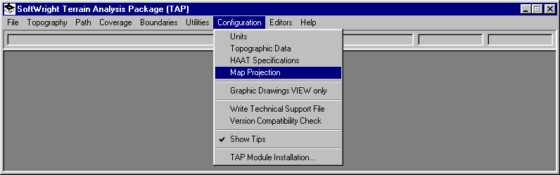
The TAP Map Projection Parameters form is displayed:
Use your left mouse to select a map projection from the list
of projections currently available in TAP. When you select a
projection, the applicable parameters for that projection and
their current values will be displayed.
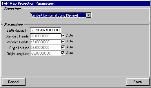
The most commonly used projection for North America is the
Lambert Conformal Conic, often used for maps of entire counties.
This projection is available in TAP.
For additional information on map projections and their parameters,
see Map Projections, A Working Manual, USGS Professional
Paper 1395.
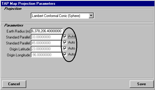
Parameters
Because of basic differences between map projections, the
particular parameters displayed will depend on the projection.
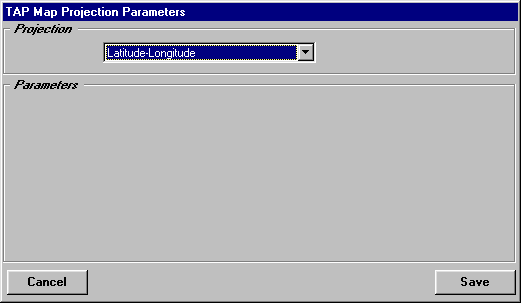
For example, the Latitude-Longitude projection simply plots longitude
and latitude values as X and Y, respectively, and requires no
parameters, while other projections may require up to 15 parameters:
Several parameters for a given projection may include a check
box option labeled "Auto" to allow each plot to be
localized. For example, the Lambert Conformal Conic projection
typically uses parameter values optimized for the entire continental
United States, including Standard Parallels and Origin values
appropriate for the entire country. The projection can be used
with minimum distortions of scale and shapes for the entire U.S.
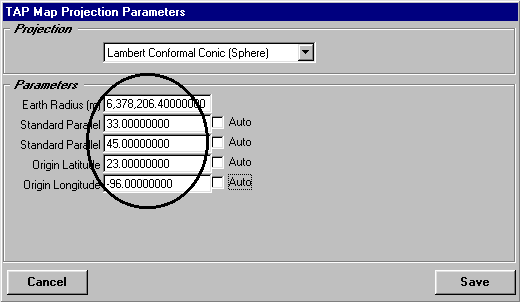
However, if you are plotting a smaller area, such as a single
state or even a few counties with a coverage area, the accuracy
of the projection for that localized area generally can be improved
by checking the Auto option for the parameters for the projection.
The Auto option computes appropriate parameters (such as Standard
Parallels and Origin in the case of Lambert Conformal Conic projections)
based on the specific area to be plotted.
After setting all the projection parameters to the values
you want, click the Save button to save the changes.
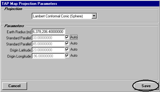
The program will use those settings for all subsequent map
plots. (Note that you cannot change the projection or parameters
of a map that is currently displayed by TAP. You can close the
map, change the parameters and save them, then redraw the map.)
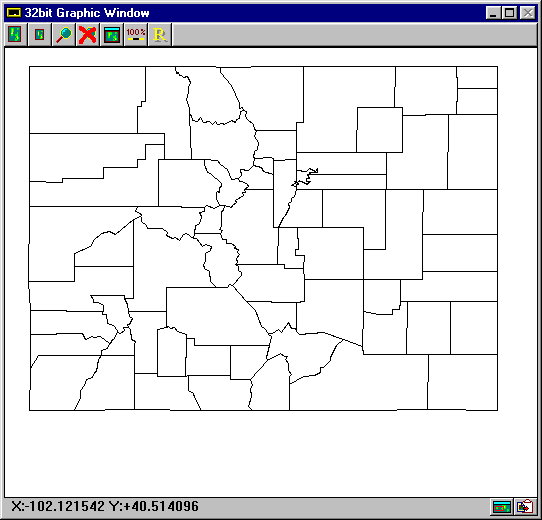
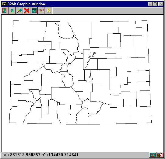
As an example, the following plots show the state of Colorado
using the Latitude-Longitude projection, the US Centered Lambert
Conformal Conic projection, and the Lambert Conformal Conic with
the "Auto" option selected for the parameters:
Latitude-Longitude:
US Centered Lambert Conformal Conic
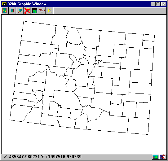
Lambert Conformal Conic "Auto"
Copyright 1999 by SoftWright LLC