Antenna Elevation Program

Q: How can I use TAP to determine the antenna height I need for a point-to-point path?

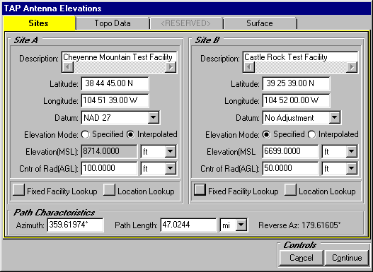
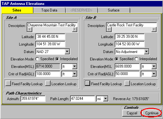
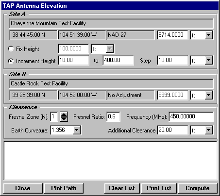
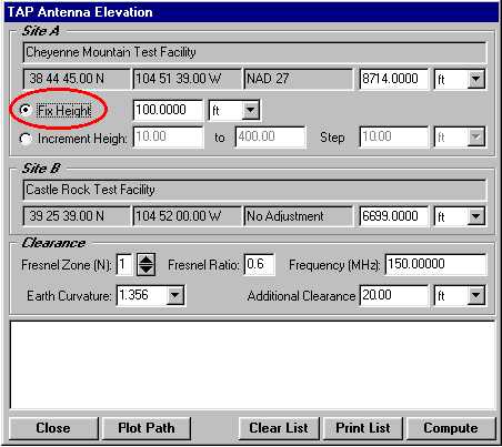
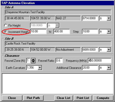
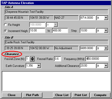
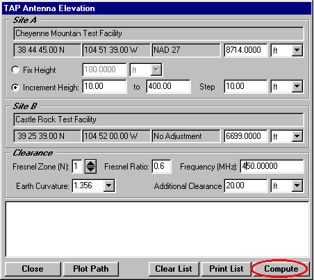
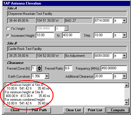
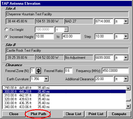
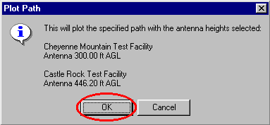
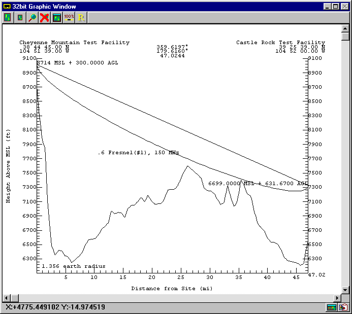
A: SoftWright’s Terrain Analysis Package (TAP)Ô (Version 4.00.201 and later, 32-bit version only) includes the optional Antenna Elevation module, found in the Path menu. This program allows you to specify the coordinates of the two end-points of a path, and the desired antenna elevation(s) on one end. You can specify the desired frequency and Fresnel zone clearance, as well as an additional "buffer" clearance value. (For example, you could specify .6 of the first Fresnel zone at 450 MHz, plus 20 feet.) The program will compute the antenna elevation on the other end of the path necessary to achieve your specifications.

(Note that TAP users with Version 5.0.1056 and later can use the HDPath interface to draw profiles and to compute antenna elevation values.)

  1. To execute the program, select Antenna Elevation under the TAP Path menu:

  2. The form will be displayed for specifying the path end-points

  3. You can also use the lookup functions to get a site from the Fixed Facility Data Base or the Location Data Base. You should set the path so that "Site A" is the site where you want to specify an antenna elevation, or a range of antenna elevations to try, and "Site B" is the site where the required antenna elevation will be computed. The Surface tab on this form allows you to include Surface Feature data base files (created with the Surface Features option under the TAP Editors menu). These files can include information about buildings, vegetation, etc., to be included in the path clearance calculations.
  4. When you have specified the site you want, click the Continue button:

  5. The Antenna Elevation form will be displayed:

  6. Since the path has been previously determined, the site coordinates are displayed but cannot be changed on this form. You can change the site elevation on either end of the path.
  7. If you want to specify a single antenna elevation, choose the "Fix Height" option and enter the antenna height at Site A. This option is useful for existing installations where there is no option to change the antenna elevation on one end.

  8. You also have the ability to select the "Increment Height" option to test a range of antenna elevations at Site A to compute the corresponding antenna elevation required at Site B. In this example, the antenna elevation at Site A will be evaluated from 10 to 400 feet above ground level (AGL) in 10 foot increments:

  9. In the Clearance section of the form, specify the clearance criteria for this path:

  1. When the Clearance information has been entered, click the Compute button.

  2. The required antenna elevations for Site B will be computed and displayed at the bottom of the form. The list will include a summay of the combinations required for the minimum antenna elevation at each end, as well as the minimum combined height. The number at the right of each line is the location of the obstacle on the path that determined the required height (i.e., the "worst case" obstruction), in this example at 35.40 miles:

  3. You can also scroll up the list to see the other computed combinations. If you want to see a profile plot of the path, select one of the combinations by clicking on the line, then click the Plot Path button:

  4. A message will be displayed describing the path to be plotted. Click OK to plot the path:

  5. The path profile will be plotted along with the selected antenna elevations:

  6. Note that you can also display the Antenna Elevation form from the Profile Plot Control form using the Ant Elv button. This gives you additional interactive capabilities for using the Antenna Elevation program.


Copyright 1999 by SoftWright LLC