Adding a Scale to the TAP Map Window

Q: How do I show a scale on my coverage map?

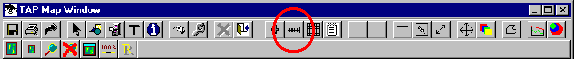
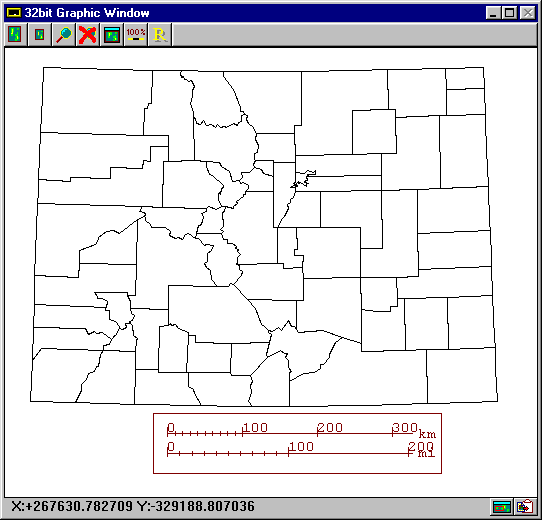
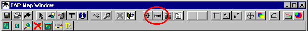
A: The TAP Map Window Control form includes several buttons for adding various features to a Map Window. (Note that the Map Window Control form is only displayed when a Map Window is displayed.) The map used in the following illustrations is the CO.BNA file of Colorado counties.
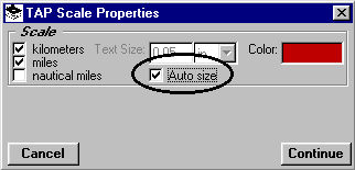
Adding a Map Scale

  • The "Scale" button enables you to add a scale of miles, kilometers, and/or nautical miles to a TAP Map Window.
  • Click the "Scale" button, and the Scale Properties form is displayed:

  • You can select the scale units to be drawn using the three check boxes on the left of the form. (You must select at least one):

  • Double-click on the color box on the form to choose the color of the scale to draw:

  • A color selection bar is displayed. Click on the color you want to use:

  • The size of the text on the scale can either be set by you, or it can be determined automatically based on the number of scale units you draw and the size of the box you draw for the scale. For this tutorial, check the "Auto Size" box. (If the "Auto Size" is not checked you can enter the size and units on the form.)

  • Click the "Continue" button to draw the scale on the map:

  • You will be prompted to draw a box on the Map Window to define the size and location of the scale:

  • Mark two corners of the area where you want the scale:

  • The scale will be added to the drawing:

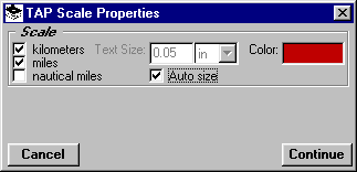
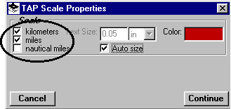
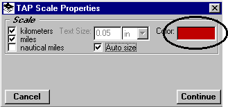
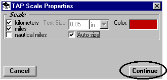
    The Scale Properties form will be displayed again. Click the "Continue" button:

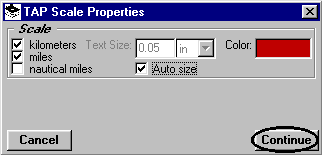
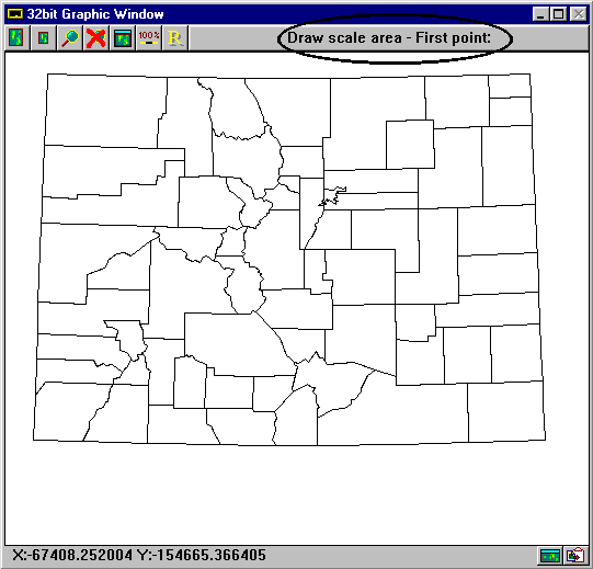
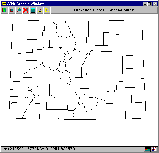
    You will be prompted to define a new scale location on the Map Window. You can specify a new location, or you can right-click with the mouse on the map to remove the old scale without drawing a new scale.


    Copyright 1999 by SoftWright LLC