We are pleased to announce today that we have released Terrain Analysis Package (TAP™) Mapper 2017.3.1, which includes the ability to use antenna patterns in Quick Coverage as well as new spreadsheet to shapefile conversion. As previously announced, Mapper is available to users of our full TAP™ RF design software and it is now also available as a standalone software subscription.
Antenna patterns in mapper quick coverage
Recall that with the release of Mapper 2017.2, a new Quick Coverage feature was included to provide a simple way to set up and run an area coverage study that will predict RF signal strength over an area using our popular Longley-Rice propagation model. The coverage prediction can include 3D buildings and obstructions based on land cover classification.
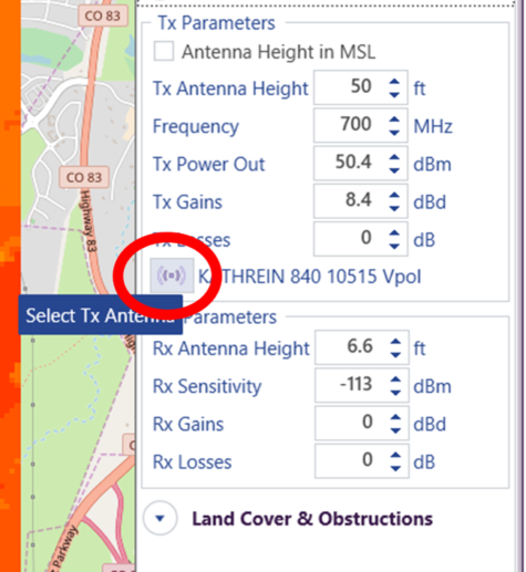
With today’s release, Mapper subscribers and TAP™ users with maintenance expiration dates of Sept 1, 2017 or later can import antenna patterns to use in Quick Coverage studies. As shown below, the antenna load button is in the Tx parameters section of the Quick Coverage side panel.
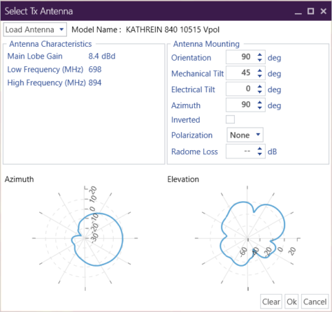
Click on the the button and a dialog window appears where antenna patterns in Generic (Planet) format or NSMA format may be selected. The required antenna pattern files are available from most antenna manufacturers. Please contact support@softwright.com if you have any questions about acquiring and using antenna patterns. When the antenna pattern file is selected and imported, the dialog shows azimuth and elevation thumbnails. Enter the mounting information for the Transmit site and click Ok to use the pattern in a Quick Coverage study.
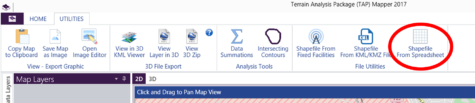
Spreadsheet to shapefile conversion
At our recent training seminar in Denver, an attendee had a .csv format spreadsheet file with lat-lon locations and field strength measurements. At his request, Mapper now provides a utility to read a .csv or .xlsx file and create a point type shapefile containing all of the spreadsheet data. Once the shapefile has been created and added as a map layer, it may be styled for visualization, exported in 3D, and used for analysis just like any other shapefile. The Spreadsheet to Shapefile conversion utility is available on the UTILITIES tab of the main ribbon bar as shown below.