Identifying Objects in HDMapper™
Q: How do I get information about the objects on the map?
A: You can identify and find information about objects on the map with the ID button or the MouseTips button.
When the ID button is depressed, mouse clicks on the map cause the program to search the database associated with the selected layer and display the information.
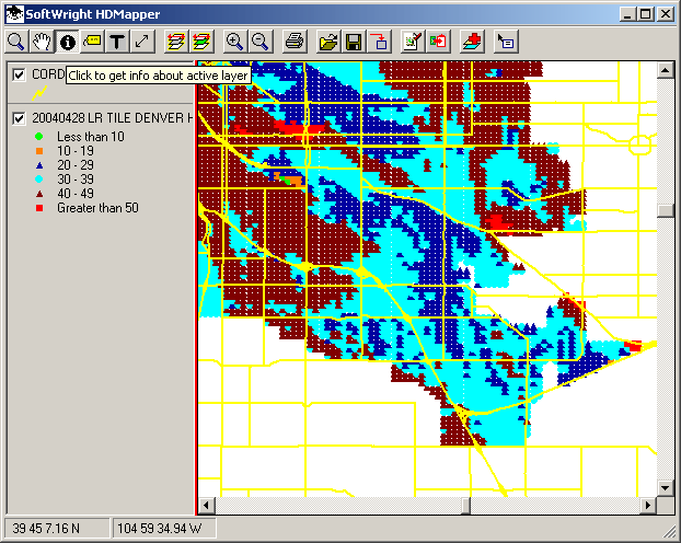
For example, suppose you have a map as shown below. The ID button is depressed, and the CORDS (Colorado Roads) layer is selected.
When you click the map, the database information for the object you clicked is displayed:
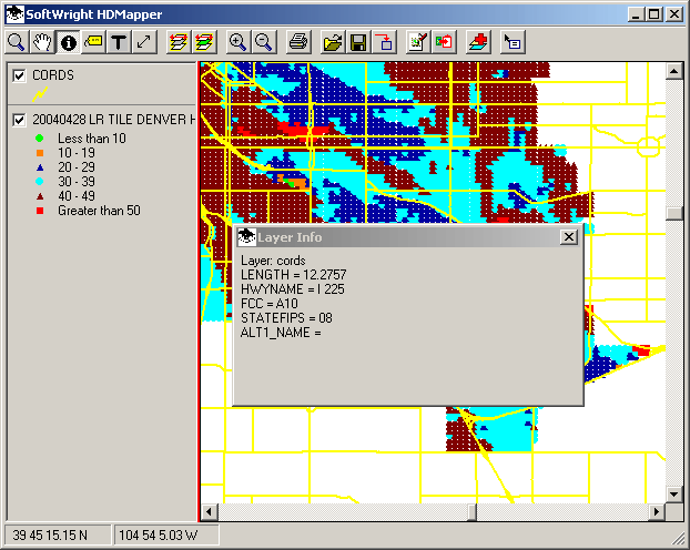
The actual information will be different for different ShapeFiles.
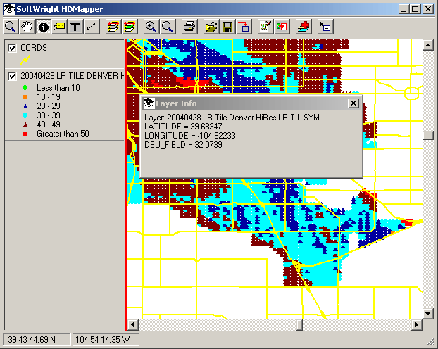
You can select a different layer on the map by clicking that layer in the legend:

With a different layer selected, and the ID button still depressed, clicking the map will display information about the location from the newly selected layer:
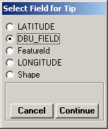
The MouseTips button enables you to select one information category (a database "field") from the currently selected layer to display at the mouse location.

When you click the MouseTips button, a list will be displayed showing the information available in the currently selected layer.
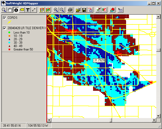
For example, with the CORDS (Colorado Roads) layer selected, clicking the MouseTips button will display a list of the information in that ShapeFile database:
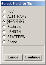
If you select the HWYNAME field and click the Continue button, the name of the highway will be displayed when you hover the mouse over an object for a few seconds:

You can select a different layer on the map by clicking that layer in the legend:

With a different layer selected, you can click the MouseTips button again to choose the information you want to display from that layer:
The mouse pointer will now display the information for the current layer:
|
|
Copyright 2004 by SoftWright LLC